Manacapuru night lights from space
Night Light of Manacapuru (Amazonas) from space (Brazil) Src. Average luminocity for 10x10km area is 23.7424% and for 50x50km: 1.1734%.
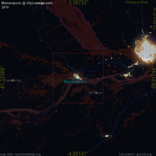
Analysis of Manacapuru night lights 2016
Square area 10x10 km:
 3.68%
3.68%90-99
3.68%80-89
3.03%70-79
1.08%60-69
3.03%50-59
2.38%40-49
7.36%30-39
4.33%20-29
4.76%10-19
11.69%0-9
54.98%Square area 50x50 km:
0.15%90-99
0.15%80-89
0.12%70-79
0.04%60-69
0.12%50-59
0.13%40-49
0.36%30-39
0.21%20-29
0.29%10-19
0.48%0-9
97.94%Clear (daylight) street map image can be seen on geolist.org.
Map coordinates:
2° 35' 51.1" South, 61° 19' 25.3" West
3° 17' 59" South, 60° 37' 14" West
4° 0' 5.1" South, 59° 55' 2.8" West
Some cities around Manacapuru sort by population:
• Manaus
69.7 km =43.3 mi,  71°
71°
• Rio Preto da Eva
122 km =75.8 mi,  56°
56°
• Borba
166.9 km =103.7 mi,  136°
136°
• Iranduba
48.3 km =30 mi,  88°
88°
• Manaquiri
30.1 km =18.7 mi, 93°
• Autazes
168.3 km =104.6 mi,  100°
100°
• Anori
125.2 km =77.8 mi,  245°
245°
• Careiro da Várzea
88.9 km =55.2 mi,  82°
82°
3663529 (p: 52,459)
Sources (retrieved 2019-11-25):
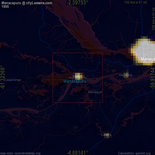
» NASA, Earths city lights 1995
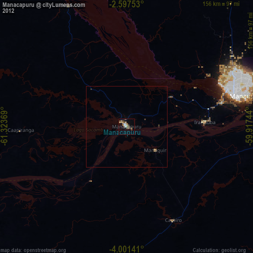
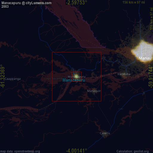
» NASA city lights 2003
» Earth at Night: Flat Maps 2012, 2016