Itatiba night lights from space
Night Light of Itatiba (São Paulo) from space (Brazil) Src. Average luminocity for 10x10km area is 61.0774% and for 50x50km: 43.6095%.
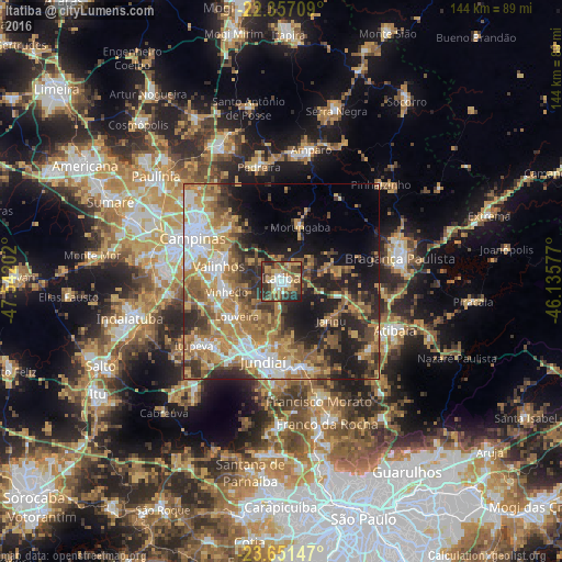
Analysis of Itatiba night lights 2016
Square area 10x10 km:
 9.13%
9.13%90-99
9.33%80-89
12.1%70-79
8.13%60-69
12.1%50-59
9.13%40-49
17.26%30-39
11.11%20-29
11.31%10-19
0.4%0-9
0%Square area 50x50 km:
6.19%90-99
6.4%80-89
5.42%70-79
9.04%60-69
9.51%50-59
7.7%40-49
5.99%30-39
6.46%20-29
9.9%10-19
12.61%0-9
20.77%Clear (daylight) street map image can be seen on geolist.org.
Map coordinates:
22° 21' 25.5" South, 47° 32' 31.3" West
23° 0' 21" South, 46° 50' 20" West
23° 39' 5.3" South, 46° 8' 8.8" West
Some cities around Itatiba sort by population:
• Campinas
25.3 km =15.7 mi,  296°
296°
• Jundiaí
20.6 km =12.8 mi,  192°
192°
• Várzea Paulista
22.9 km =14.2 mi,  177°
177°
• Valinhos
16.5 km =10.3 mi,  283°
283°
• Vinhedo
14.2 km =8.8 mi,  259°
259°
• Louveira
14.5 km =9 mi,  231°
231°
• Itupeva
27.7 km =17.2 mi, 233°
• Jarinu
15.5 km =9.6 mi,  133°
133°
3460598 (p: 67,934)
Sources (retrieved 2019-11-25):
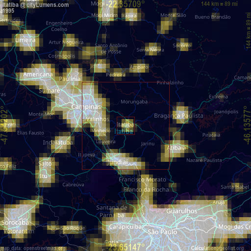
» NASA, Earths city lights 1995
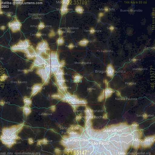
» NASA city lights 2003
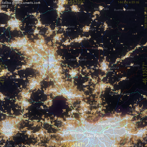
» Earth at Night: Flat Maps 2012, 2016