Valinhos night lights from space
Night Light of Valinhos (São Paulo) from space (Brazil) Src. Average luminocity for 10x10km area is 81.0873% and for 50x50km: 56.2671%.
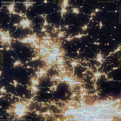
Analysis of Valinhos night lights 2016
Square area 10x10 km:
 19.44%
90-99
22.82%80-89
9.13%70-79
23.81%60-69
11.11%50-59
8.93%40-49
3.57%30-39
1.19%20-29
0%10-19
0%0-9
0%Square area 50x50 km:
9.48%90-99
10.04%80-89
9.13%70-79
13.29%60-69
10.84%50-59
7.77%40-49
6.55%30-39
5.46%20-29
7.95%10-19
8.9%0-9
10.6%Clear (daylight) street map image can be seen on geolist.org.
Map coordinates:
22° 19' 17.9" South, 47° 41' 56.3" West
22° 58' 14" South, 46° 59' 45" West
23° 36' 58.9" South, 46° 17' 33.8" West
Some cities around Valinhos sort by population:
• Campinas
9.8 km =6.1 mi,  317°
317°
• Jundiaí
26.6 km =16.5 mi,  154°
154°
• Hortolândia
26.1 km =16.2 mi,  298°
298°
• Indaiatuba
25.7 km =16 mi,  239°
239°
• Itatiba
16.5 km =10.3 mi,  103°
103°
• Vinhedo
6.9 km =4.3 mi,  162°
162°
• Louveira
13.7 km =8.5 mi, 160°
• Itupeva
21.3 km =13.2 mi,  197°
197°
3445578 (p: 88,630)
Sources (retrieved 2019-11-25):
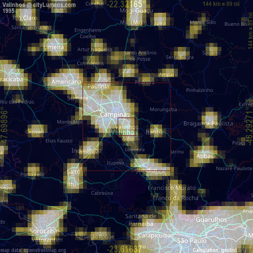
» NASA, Earths city lights 1995
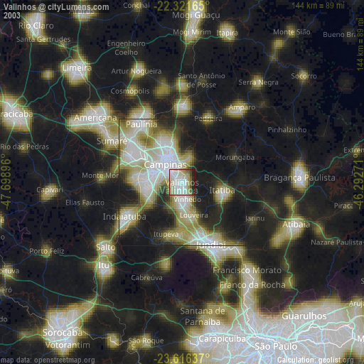
» NASA city lights 2003
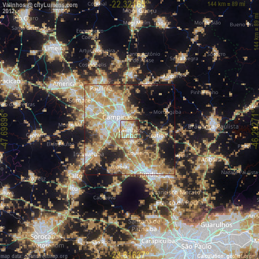
» Earth at Night: Flat Maps 2012, 2016