Várzea Paulista night lights from space
Night Light of Várzea Paulista (São Paulo) from space (Brazil) Src. Average luminocity for 10x10km area is 80.947% and for 50x50km: 49.8916%.
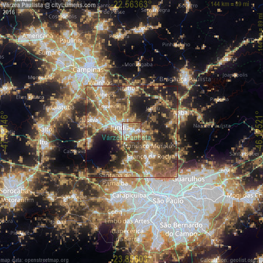
Analysis of Várzea Paulista night lights 2016
Square area 10x10 km:
 20.83%
90-99
20.83%80-89
11.55%70-79
15.53%60-69
18.94%50-59
10.04%40-49
1.7%30-39
0.57%20-29
0%10-19
0%0-9
0%Square area 50x50 km:
4.98%90-99
6.07%80-89
5.45%70-79
9.7%60-69
12.72%50-59
12.53%40-49
10%30-39
8.44%20-29
11.89%10-19
12.15%0-9
6.08%Clear (daylight) street map image can be seen on geolist.org.
Map coordinates:
22° 33' 49.1" South, 47° 31' 53.3" West
23° 12' 41" South, 46° 49' 42" West
23° 51' 21.7" South, 46° 7' 30.8" West
Some cities around Várzea Paulista sort by population:
• Jundiaí
6.3 km =3.9 mi,  295°
295°
• Francisco Morato
11.5 km =7.1 mi,  132°
132°
• Franco da Rocha
16.1 km =10 mi,  139°
139°
• Caieiras
19.2 km =11.9 mi,  152°
152°
• Itatiba
22.9 km =14.2 mi,  357°
357°
• Cajamar
16.8 km =10.4 mi,  197°
197°
• Louveira
18.7 km =11.6 mi,  318°
318°
• Jarinu
15.9 km =9.9 mi,  39°
39°
3445446 (p: 110,936)
Sources (retrieved 2019-11-25):
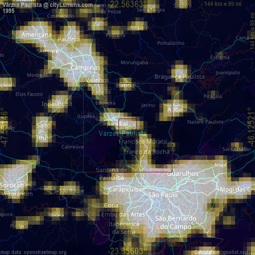
» NASA, Earths city lights 1995
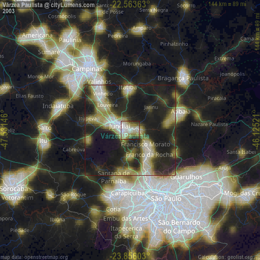
» NASA city lights 2003
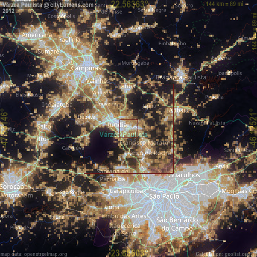
» Earth at Night: Flat Maps 2012, 2016