Jundiaí night lights from space
Night Light of Jundiaí (São Paulo) from space (Brazil) Src. Average luminocity for 10x10km area is 87.2652% and for 50x50km: 49.1566%.
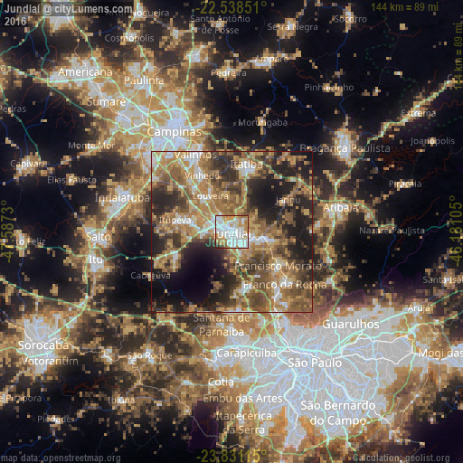

Analysis of Jundiaí night lights 2016
Square area 10x10 km:
 32.58%
90-99
28.6%80-89
5.68%70-79
16.86%60-69
10.98%50-59
1.89%40-49
1.14%30-39
1.7%20-29
0.57%10-19
0%0-9
0%Square area 50x50 km:
5.14%90-99
6.23%80-89
5.67%70-79
9.92%60-69
11.79%50-59
11.66%40-49
9.28%30-39
8%20-29
11.62%10-19
13.3%0-9
7.38%Clear (daylight) street map image can be seen on geolist.org.
Map coordinates:
22° 32' 18.6" South, 47° 35' 14.3" West
23° 11' 11" South, 46° 53' 3" West
23° 49' 52.1" South, 46° 10' 51.8" West
Some cities around Jundiaí sort by population:
• Francisco Morato
17.7 km =11 mi,  126°
126°
• Várzea Paulista
6.3 km =3.9 mi,  115°
115°
• Itatiba
20.6 km =12.8 mi,  12°
12°
• Cajamar
18.9 km =11.7 mi,  177°
177°
• Vinhedo
19.8 km =12.3 mi,  331°
331°
• Louveira
13 km =8.1 mi, 328°
• Itupeva
18.1 km =11.2 mi,  281°
281°
• Jarinu
18.5 km =11.5 mi,  59°
59°
3459462 (p: 321,589)
Sources (retrieved 2019-11-25):
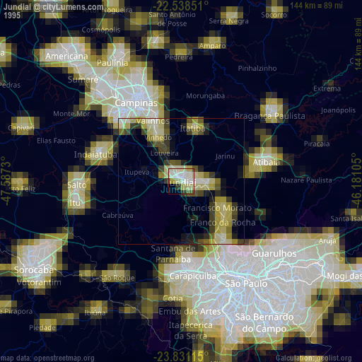
» NASA, Earths city lights 1995
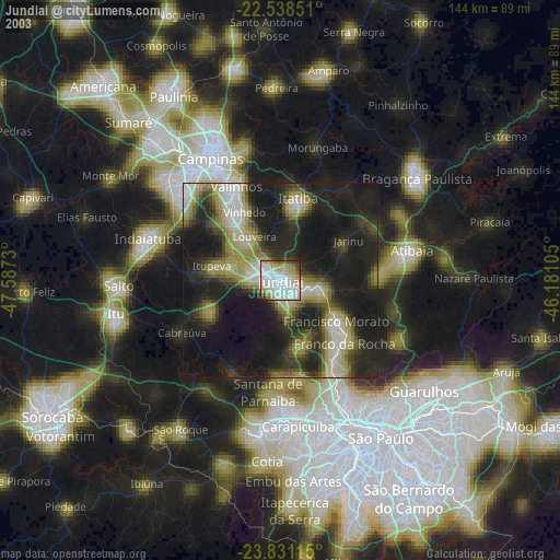
» NASA city lights 2003
» Earth at Night: Flat Maps 2012, 2016