Itabuna night lights from space
Night Light of Itabuna (Bahia) from space (Brazil) Src. Average luminocity for 10x10km area is 52.7438% and for 50x50km: 6.7701%.
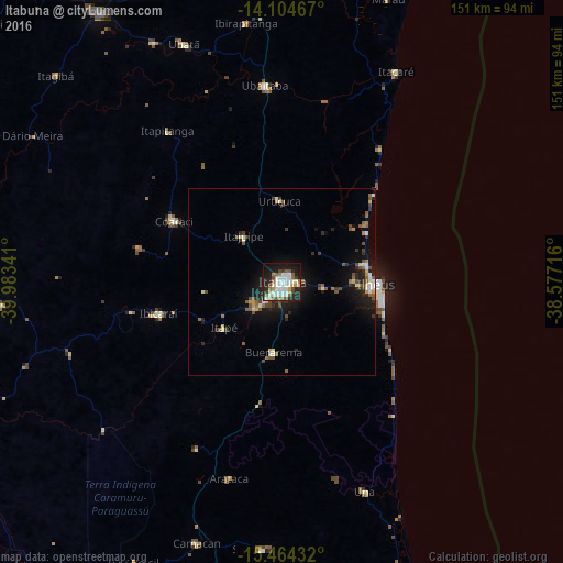
Analysis of Itabuna night lights 2016
Square area 10x10 km:
 14.26%
90-99
15.5%80-89
1.86%70-79
5.58%60-69
5.79%50-59
7.85%40-49
4.13%30-39
2.89%20-29
13.64%10-19
24.17%0-9
4.34%Square area 50x50 km:
0.78%90-99
1.25%80-89
0.48%70-79
0.59%60-69
0.64%50-59
1.45%40-49
1.05%30-39
0.77%20-29
2%10-19
5.1%0-9
85.9%Clear (daylight) street map image can be seen on geolist.org.
Map coordinates:
14° 6' 16.8" South, 39° 59' 0.3" West
14° 47' 8" South, 39° 16' 49" West
15° 27' 51.6" South, 38° 34' 37.8" West
Some cities around Itabuna sort by population:
• Ilhéus
25.9 km =16.1 mi,  91°
91°
• Coaraci
33.3 km =20.7 mi,  298°
298°
• Ubaitaba
52.8 km =32.8 mi,  354°
354°
• Uruçuca
21.4 km =13.3 mi,  358°
358°
• Una
60.6 km =37.7 mi,  158°
158°
• Ibicaraí
34.2 km =21.3 mi,  255°
255°
• Buerarema
19.4 km =12.1 mi,  186°
186°
• Itajuípe
15.7 km =9.8 mi,  319°
319°
3460949 (p: 205,660)
Sources (retrieved 2019-11-25):
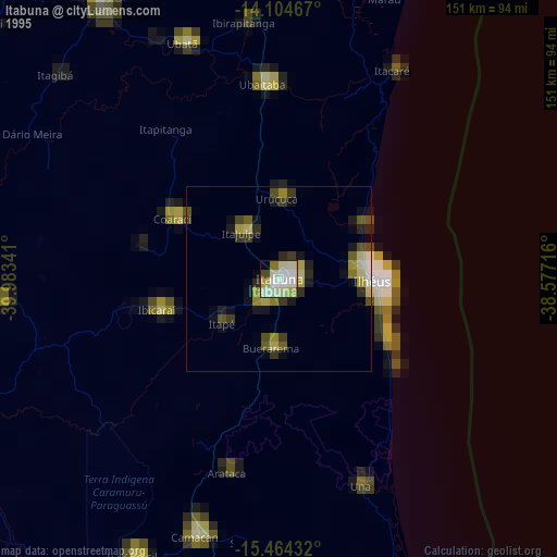
» NASA, Earths city lights 1995
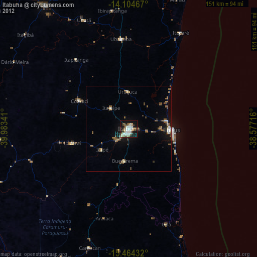
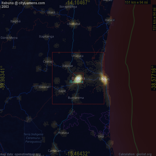
» NASA city lights 2003
» Earth at Night: Flat Maps 2012, 2016