Buerarema night lights from space
Night Light of Buerarema (Bahia) from space (Brazil) Src. Average luminocity for 10x10km area is 6.6405% and for 50x50km: 5.0912%.
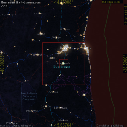
Analysis of Buerarema night lights 2016
Square area 10x10 km:
 0%
0%90-99
2.27%80-89
1.03%70-79
0%60-69
0.83%50-59
2.48%40-49
1.03%30-39
0.62%20-29
0%10-19
0%0-9
91.74%Square area 50x50 km:
0.63%90-99
0.9%80-89
0.4%70-79
0.39%60-69
0.49%50-59
1.12%40-49
0.74%30-39
0.49%20-29
1.61%10-19
4.39%0-9
88.85%Clear (daylight) street map image can be seen on geolist.org.
Map coordinates:
14° 16' 44.7" South, 40° 0' 10.3" West
14° 57' 34" South, 39° 17' 59" West
15° 38' 15.5" South, 38° 35' 47.8" West
Some cities around Buerarema sort by population:
• Itabuna
19.4 km =12.1 mi,  6°
6°
• Ilhéus
33.5 km =20.8 mi,  56°
56°
• Coaraci
44.6 km =27.7 mi,  322°
322°
• Uruçuca
40.8 km =25.4 mi,  2°
2°
• Una
44.3 km =27.5 mi,  147°
147°
• Ibicaraí
32.7 km =20.3 mi,  288°
288°
• Mascote
67.1 km =41.7 mi,  180°
180°
• Itajuípe
32.3 km =20.1 mi,  345°
345°
3468858 (p: 16,001)
Sources (retrieved 2019-11-25):
» Earth at Night: Flat Maps 2012, 2016