Ilhéus night lights from space
Night Light of Ilhéus (Bahia) from space (Brazil) Src. Average luminocity for 10x10km area is 41.3884% and for 50x50km: 5.2307%.
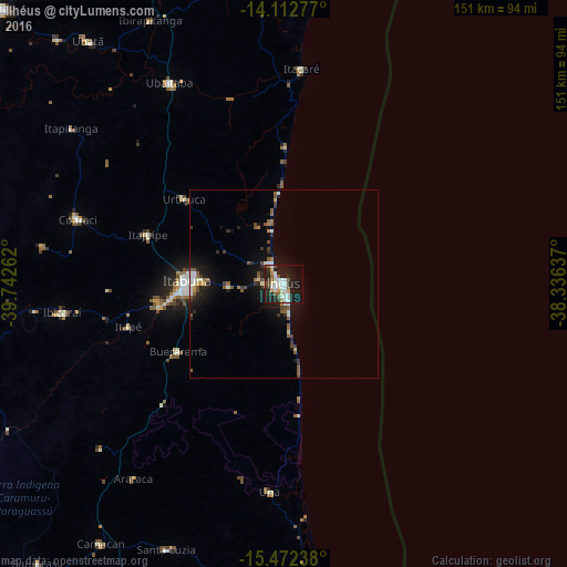
Analysis of Ilhéus night lights 2016
Square area 10x10 km:
 9.09%
9.09%90-99
12.81%80-89
2.69%70-79
2.69%60-69
1.86%50-59
5.37%40-49
3.51%30-39
2.69%20-29
14.46%10-19
34.5%0-9
10.33%Square area 50x50 km:
0.64%90-99
0.98%80-89
0.28%70-79
0.34%60-69
0.4%50-59
1.22%40-49
0.67%30-39
0.61%20-29
1.53%10-19
4.78%0-9
88.55%Clear (daylight) street map image can be seen on geolist.org.
Map coordinates:
14° 6' 46" South, 39° 44' 33.4" West
14° 47' 37.1" South, 39° 2' 22.2" West
15° 28' 20.6" South, 38° 20' 10.9" West
Some cities around Ilhéus sort by population:
• Itabuna
25.9 km =16.1 mi,  271°
271°
• Coaraci
57.6 km =35.8 mi,  287°
287°
• Uruçuca
34.5 km =21.4 mi,  310°
310°
• Una
55.7 km =34.6 mi,  183°
183°
• Ibicaraí
59.4 km =36.9 mi,  262°
262°
• Buerarema
33.5 km =20.8 mi,  236°
236°
• Itajuípe
38.3 km =23.8 mi, 289°
• Itacaré
57.4 km =35.7 mi,  4°
4°
3461408 (p: 155,499)
Sources (retrieved 2019-11-25):
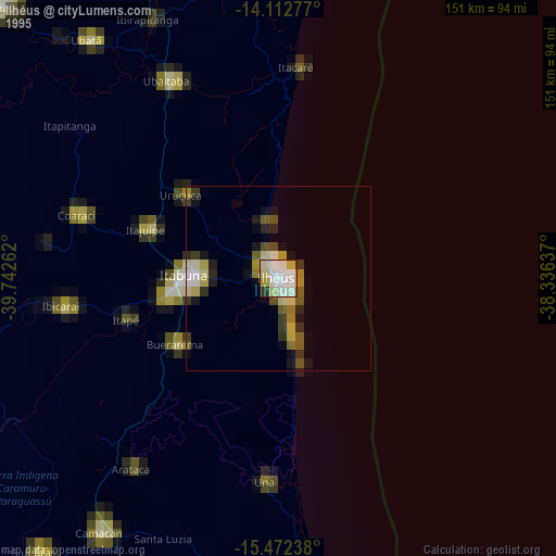
» NASA, Earths city lights 1995
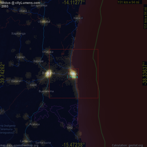
» NASA city lights 2003
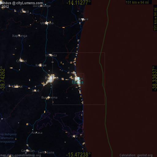
» Earth at Night: Flat Maps 2012, 2016