Ibicaraí night lights from space
Night Light of Ibicaraí (Bahia) from space (Brazil) Src. Average luminocity for 10x10km area is 9.3079% and for 50x50km: 1.5659%.
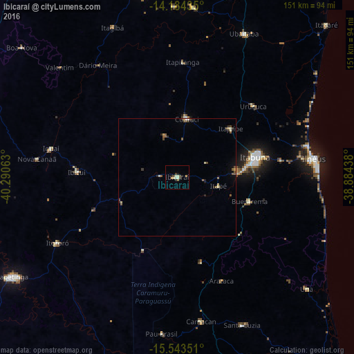
Analysis of Ibicaraí night lights 2016
Square area 10x10 km:
 0%
0%90-99
3.31%80-89
0.83%70-79
0.83%60-69
1.65%50-59
0%40-49
2.07%30-39
1.45%20-29
1.24%10-19
1.86%0-9
86.78%Square area 50x50 km:
0.02%90-99
0.27%80-89
0.23%70-79
0.1%60-69
0.12%50-59
0.46%40-49
0.35%30-39
0.25%20-29
0.34%10-19
0.21%0-9
97.64%Clear (daylight) street map image can be seen on geolist.org.
Map coordinates:
14° 11' 3.7" South, 40° 17' 26.3" West
14° 51' 54" South, 39° 35' 15" West
15° 32' 36.6" South, 38° 53' 3.8" West
Some cities around Ibicaraí sort by population:
• Itabuna
34.2 km =21.3 mi,  75°
75°
• Coaraci
25.2 km =15.7 mi,  8°
8°
• Uruçuca
44.5 km =27.7 mi,  47°
47°
• Itororó
58.9 km =36.6 mi,  241°
241°
• Buerarema
32.7 km =20.3 mi,  108°
108°
• Itajuípe
30.9 km =19.2 mi, 47°
• Iguaí
55.3 km =34.4 mi,  282°
282°
• Ibicuí
43 km =26.7 mi,  273°
273°
3461606 (p: 19,574)
Sources (retrieved 2019-11-25):
» Earth at Night: Flat Maps 2012, 2016