Una night lights from space
Night Light of Una (Bahia) from space (Brazil) Src. Average luminocity for 10x10km area is 4.5579% and for 50x50km: 0.4869%.

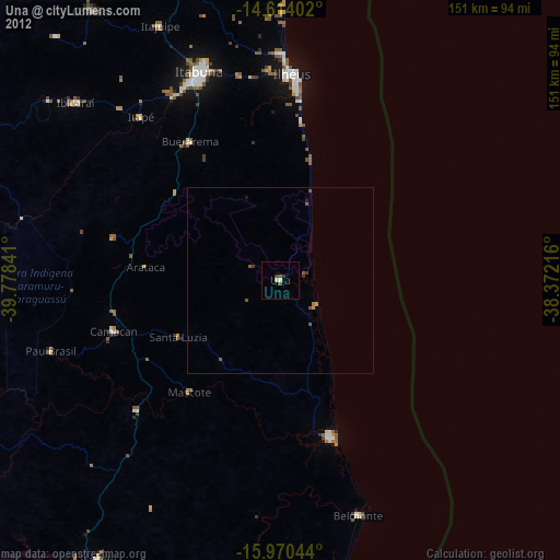
Analysis of Una night lights 2016
Square area 10x10 km:
 0%
0%90-99
1.03%80-89
0.62%70-79
0.83%60-69
0.62%50-59
1.86%40-49
0%30-39
0.83%20-29
0%10-19
0%0-9
94.21%Square area 50x50 km:
0%90-99
0.04%80-89
0.06%70-79
0.03%60-69
0.11%50-59
0.24%40-49
0.18%30-39
0.05%20-29
0.03%10-19
0%0-9
99.26%Clear (daylight) street map image can be seen on geolist.org.
Map coordinates:
14° 36' 50.5" South, 39° 46' 42.3" West
15° 17' 36" South, 39° 4' 31" West
15° 58' 13.6" South, 38° 22' 19.8" West
Some cities around Una sort by population:
• Itabuna
60.6 km =37.7 mi,  338°
338°
• Ilhéus
55.7 km =34.6 mi,  3°
3°
• Canavieiras
44.6 km =27.7 mi,  162°
162°
• Ibicaraí
72.7 km =45.2 mi,  310°
310°
• Mascote
38.6 km =24 mi,  219°
219°
• Buerarema
44.3 km =27.5 mi,  327°
327°
• Belmonte
66.5 km =41.3 mi, 161°
• Pau Brasil
64.6 km =40.1 mi,  252°
252°
3445781 (p: 22,613)
Sources (retrieved 2019-11-25):
» Earth at Night: Flat Maps 2012, 2016