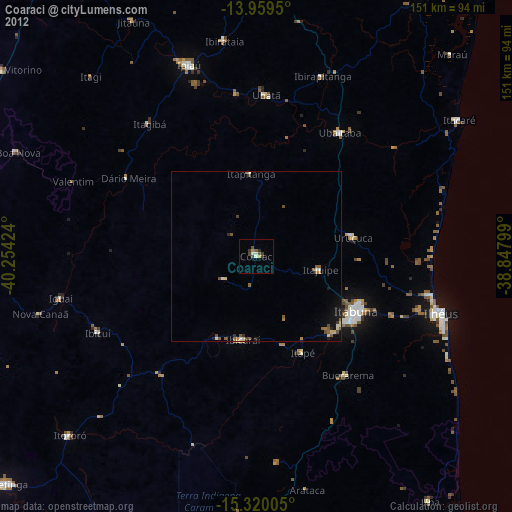
Coaraci night lights from space
Night Light of Coaraci (Bahia) from space (Brazil) Src. Average luminocity for 10x10km area is 10.4394% and for 50x50km: 2.0864%.
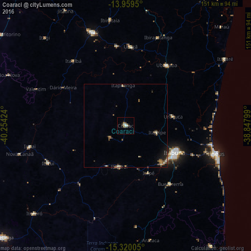
Analysis of Coaraci night lights 2016
Square area 10x10 km:
 1.3%
1.3%90-99
2.16%80-89
0.65%70-79
1.08%60-69
0.87%50-59
1.73%40-49
2.6%30-39
0.87%20-29
2.81%10-19
1.52%0-9
84.42%Square area 50x50 km:
0.08%90-99
0.36%80-89
0.19%70-79
0.19%60-69
0.22%50-59
0.58%40-49
0.47%30-39
0.27%20-29
0.48%10-19
1.1%0-9
96.06%Clear (daylight) street map image can be seen on geolist.org.
Map coordinates:
13° 57' 34.2" South, 40° 15' 15.3" West
14° 38' 27" South, 39° 33' 4" West
15° 19' 12.2" South, 38° 50' 52.8" West
Some cities around Coaraci sort by population:
• Itabuna
33.3 km =20.7 mi,  118°
118°
• Ubaitaba
44 km =27.3 mi,  33°
33°
• Uruçuca
29.2 km =18.1 mi,  79°
79°
• Ibicaraí
25.2 km =15.7 mi,  188°
188°
• Buerarema
44.6 km =27.7 mi,  142°
142°
• Ubatã
48.1 km =29.9 mi,  3°
3°
• Itajuípe
19.4 km =12.1 mi,  102°
102°
• Itagibá
50.6 km =31.4 mi,  321°
321°
3466041 (p: 32,344)
Sources (retrieved 2019-11-25):
» Earth at Night: Flat Maps 2012, 2016