Goiás night lights from space
Night Light of Goiás from space (Brazil) Src. Average luminocity for 10x10km area is 15.5866% and for 50x50km: 0.7897%.
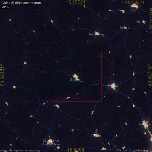
Analysis of Goiás night lights 2016
Square area 10x10 km:
 0.65%
0.65%90-99
1.95%80-89
0.87%70-79
4.55%60-69
4.55%50-59
2.6%40-49
2.81%30-39
0.22%20-29
0%10-19
0%0-9
81.82%Square area 50x50 km:
0.02%90-99
0.07%80-89
0.03%70-79
0.3%60-69
0.17%50-59
0.12%40-49
0.11%30-39
0.01%20-29
0.13%10-19
0%0-9
99.02%Clear (daylight) street map image can be seen on geolist.org.
Map coordinates:
15° 15' 26" South, 50° 50' 36.3" West
15° 56' 4" South, 50° 8' 25" West
16° 36' 33.8" South, 49° 26' 13.8" West
Some cities around Goiás sort by population:
• São Luís de Montes Belos
70.2 km =43.6 mi,  200°
200°
• Itaberaí
36.5 km =22.7 mi,  105°
105°
• Itapuranga
46.2 km =28.7 mi,  26°
26°
• Anicuns
61.6 km =38.3 mi,  161°
161°
• Uruana
68.5 km =42.6 mi,  45°
45°
• Firminópolis
74.1 km =46 mi,  193°
193°
• Itapirapuã
52.1 km =32.4 mi,  283°
283°
• Carmo do Rio Verde
79.5 km =49.4 mi,  35°
35°
3462374 (p: 19,098)
Sources (retrieved 2019-11-25):
» Earth at Night: Flat Maps 2012, 2016