Carmo do Rio Verde night lights from space
Night Light of Carmo do Rio Verde (Goiás) from space (Brazil) Src. Average luminocity for 10x10km area is 5.974% and for 50x50km: 2.4983%.
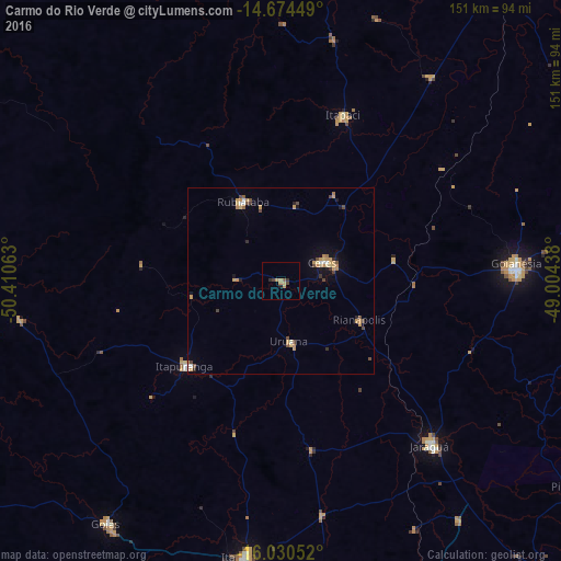
Analysis of Carmo do Rio Verde night lights 2016
Square area 10x10 km:
 0%
0%90-99
0%80-89
0.65%70-79
3.46%60-69
0.22%50-59
0.87%40-49
1.52%30-39
1.08%20-29
0.87%10-19
0.87%0-9
90.48%Square area 50x50 km:
0.12%90-99
0.18%80-89
0.24%70-79
1.06%60-69
0.23%50-59
0.13%40-49
0.67%30-39
0.23%20-29
0.25%10-19
0.72%0-9
96.18%Clear (daylight) street map image can be seen on geolist.org.
Map coordinates:
14° 40' 28.2" South, 50° 24' 38.3" West
15° 21' 13" South, 49° 42' 27" West
16° 1' 49.9" South, 49° 0' 15.8" West
Some cities around Carmo do Rio Verde sort by population:
• Goianésia
63.4 km =39.4 mi,  86°
86°
• Jaraguá
60.1 km =37.3 mi,  138°
138°
• Itapuranga
34.7 km =21.6 mi,  228°
228°
• Ceres
12.7 km =7.9 mi,  66°
66°
• Rubiataba
23.4 km =14.5 mi,  333°
333°
• Itapaci
47.9 km =29.8 mi,  20°
20°
• Uruana
16.9 km =10.5 mi,  170°
170°
• Rialma
13.9 km =8.6 mi, 71°
3466900 (p: 6,053)
Sources (retrieved 2019-11-25):
» Earth at Night: Flat Maps 2012, 2016