Itapuranga night lights from space
Night Light of Itapuranga (Goiás) from space (Brazil) Src. Average luminocity for 10x10km area is 12.4113% and for 50x50km: 0.8162%.
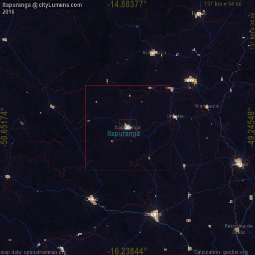
Analysis of Itapuranga night lights 2016
Square area 10x10 km:
 1.73%
1.73%90-99
2.6%80-89
1.52%70-79
2.81%60-69
1.73%50-59
0%40-49
1.3%30-39
0.43%20-29
0.87%10-19
0.87%0-9
86.15%Square area 50x50 km:
0.07%90-99
0.1%80-89
0.06%70-79
0.33%60-69
0.08%50-59
0.02%40-49
0.13%30-39
0.05%20-29
0.14%10-19
0.19%0-9
98.83%Clear (daylight) street map image can be seen on geolist.org.
Map coordinates:
14° 53' 1.6" South, 50° 39' 6.3" West
15° 33' 44" South, 49° 56' 55" West
16° 14' 18.4" South, 49° 14' 43.8" West
Some cities around Itapuranga sort by population:
• Jaraguá
69.2 km =43 mi,  108°
108°
• Itaberaí
53 km =32.9 mi,  163°
163°
• Goiás
46.2 km =28.7 mi,  206°
206°
• Ceres
47 km =29.2 mi,  53°
53°
• Rubiataba
46.9 km =29.1 mi,  19°
19°
• Uruana
29.2 km =18.1 mi,  77°
77°
• Rialma
47.7 km =29.6 mi, 54°
• Carmo do Rio Verde
34.7 km =21.6 mi, 48°
3460648 (p: 19,709)
Sources (retrieved 2019-11-25):
» Earth at Night: Flat Maps 2012, 2016