Fernandópolis night lights from space
Night Light of Fernandópolis (São Paulo) from space (Brazil) Src. Average luminocity for 10x10km area is 36.1587% and for 50x50km: 3.2217%.
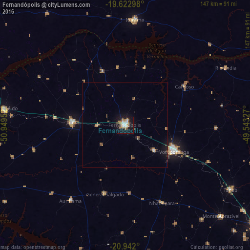
Analysis of Fernandópolis night lights 2016
Square area 10x10 km:
 5.75%
5.75%90-99
6.15%80-89
5.75%70-79
6.55%60-69
6.15%50-59
2.18%40-49
1.79%30-39
3.37%20-29
3.37%10-19
41.47%0-9
17.46%Square area 50x50 km:
0.31%90-99
0.32%80-89
0.24%70-79
0.61%60-69
0.62%50-59
0.36%40-49
0.45%30-39
0.39%20-29
0.4%10-19
2.81%0-9
93.5%Clear (daylight) street map image can be seen on geolist.org.
Map coordinates:
19° 37' 22.7" South, 50° 56' 58.3" West
20° 17' 2" South, 50° 14' 47" West
20° 56' 31.2" South, 49° 32' 35.8" West
Some cities around Fernandópolis sort by population:
• Votuporanga
32.4 km =20.1 mi,  118°
118°
• Jales
31.3 km =19.4 mi,  273°
273°
• Iturama
62 km =38.5 mi,  4°
4°
• Auriflama
55 km =34.2 mi,  215°
215°
• Riolândia
67.9 km =42.2 mi,  60°
60°
• Cardoso
41.3 km =25.7 mi, 57°
• Nhandeara
49.9 km =31 mi,  154°
154°
• General Salgado
42.2 km =26.2 mi,  196°
196°
3463432 (p: 61,931)
Sources (retrieved 2019-11-25):
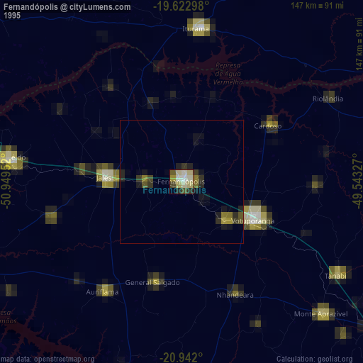
» NASA, Earths city lights 1995
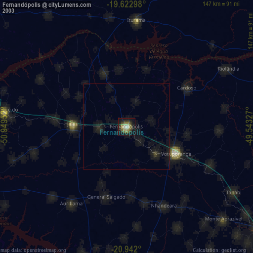
» NASA city lights 2003
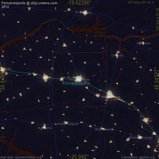
» Earth at Night: Flat Maps 2012, 2016