Nhandeara night lights from space
Night Light of Nhandeara (São Paulo) from space (Brazil) Src. Average luminocity for 10x10km area is 6.0019% and for 50x50km: 1.4064%.
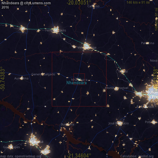
Analysis of Nhandeara night lights 2016
Square area 10x10 km:
 0%
0%90-99
0.76%80-89
0%70-79
3.03%60-69
0.38%50-59
0.38%40-49
2.27%30-39
0.19%20-29
1.89%10-19
0.19%0-9
90.91%Square area 50x50 km:
0%90-99
0.06%80-89
0.04%70-79
0.45%60-69
0.39%50-59
0.22%40-49
0.42%30-39
0.22%20-29
0.22%10-19
0.4%0-9
97.58%Clear (daylight) street map image can be seen on geolist.org.
Map coordinates:
20° 1' 49.8" South, 50° 44' 37.8" West
20° 41' 22.9" South, 50° 2' 26.5" West
21° 20' 45.7" South, 49° 20' 15.3" West
Some cities around Nhandeara sort by population:
• Votuporanga
30.5 km =19 mi,  13°
13°
• Fernandópolis
49.9 km =31 mi,  334°
334°
• José Bonifácio
54.5 km =33.9 mi,  137°
137°
• Tanabi
41.3 km =25.7 mi,  80°
80°
• Monte Aprazível
35.2 km =21.9 mi,  105°
105°
• Buritama
43.3 km =26.9 mi,  194°
194°
• Auriflama
53.5 km =33.2 mi,  270°
270°
• General Salgado
33.6 km =20.9 mi,  277°
277°
3456309 (p: 10,000)
Sources (retrieved 2019-11-25):
» Earth at Night: Flat Maps 2012, 2016