Faxinal night lights from space
Night Light of Faxinal (Paraná) from space (Brazil) Src. Average luminocity for 10x10km area is 8.2652% and for 50x50km: 1.0956%.
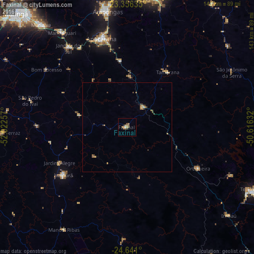
Analysis of Faxinal night lights 2016
Square area 10x10 km:
 0.38%
0.38%90-99
0.38%80-89
0.57%70-79
3.22%60-69
0.95%50-59
3.6%40-49
0.76%30-39
0.19%20-29
0.57%10-19
0%0-9
89.39%Square area 50x50 km:
0.02%90-99
0.04%80-89
0.12%70-79
0.34%60-69
0.2%50-59
0.23%40-49
0.27%30-39
0.15%20-29
0.18%10-19
0.02%0-9
98.43%Clear (daylight) street map image can be seen on geolist.org.
Map coordinates:
23° 21' 22.9" South, 52° 1' 21.3" West
24° 0' 1" South, 51° 19' 10" West
24° 38' 27.6" South, 50° 36' 58.8" West
Some cities around Faxinal sort by population:
• Apucarana
52 km =32.3 mi,  343°
343°
• Arapongas
65.5 km =40.7 mi,  350°
350°
• Rolândia
76.9 km =47.8 mi,  356°
356°
• Mandaguari
61.7 km =38.3 mi,  324°
324°
• Marialva
74.8 km =46.5 mi, 320°
• Jandaia do Sul
55.1 km =34.2 mi, 323°
• Ortigueira
44.1 km =27.4 mi,  121°
121°
• Cândido de Abreu
63 km =39.1 mi,  181°
181°
3463573 (p: 13,464)
Sources (retrieved 2019-11-25):
» Earth at Night: Flat Maps 2012, 2016