Coari night lights from space
Night Light of Coari (Amazonas) from space (Brazil) Src. Average luminocity for 10x10km area is 14.5671% and for 50x50km: 0.6905%.
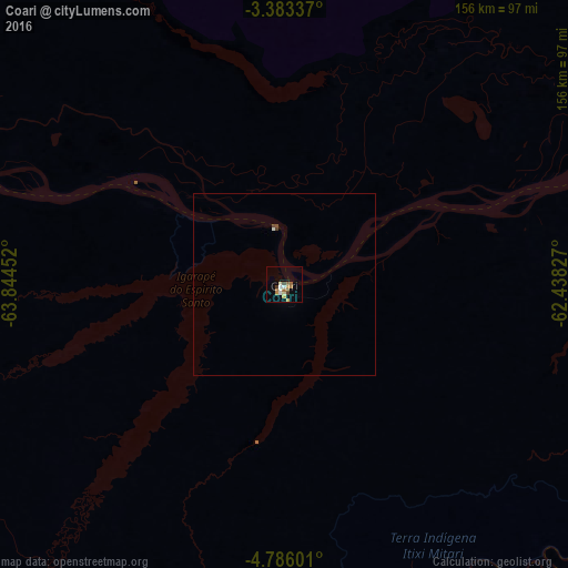

Analysis of Coari night lights 2016
Square area 10x10 km:
 0.87%
0.87%90-99
2.6%80-89
2.6%70-79
2.38%60-69
3.25%50-59
2.16%40-49
0.87%30-39
1.73%20-29
0%10-19
0.43%0-9
83.12%Square area 50x50 km:
0.04%90-99
0.13%80-89
0.1%70-79
0.09%60-69
0.13%50-59
0.08%40-49
0.11%30-39
0.09%20-29
0%10-19
0.02%0-9
99.2%Clear (daylight) street map image can be seen on geolist.org.
Map coordinates:
3° 23' 0.1" South, 63° 50' 40.3" West
4° 5' 6" South, 63° 8' 29" West
4° 47' 9.6" South, 62° 26' 17.8" West
Some cities around Coari sort by population:
• Manacapuru
293 km =182.1 mi,  72°
72°
• Tefé
192.5 km =119.6 mi,  294°
294°
• Manicoré
279.9 km =173.9 mi,  133°
133°
• Codajás
123.4 km =76.7 mi,  77°
77°
• Manaquiri
321.3 km =199.6 mi, 74°
• Anori
169.7 km =105.4 mi, 78°
• Canutama
305 km =189.5 mi,  206°
206°
• Alvarães
208 km =129.2 mi,  297°
297°
3664539 (p: 50,490)
Sources (retrieved 2019-11-25):
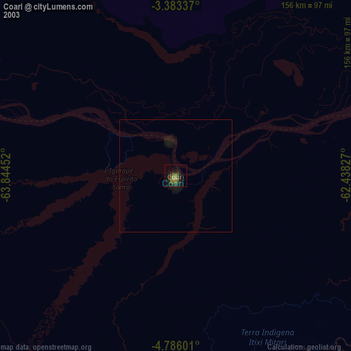
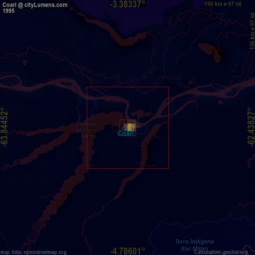
» NASA, Earths city lights 1995
» NASA city lights 2003
» Earth at Night: Flat Maps 2012, 2016