Caxias do Sul night lights from space
Night Light of Caxias do Sul (Rio Grande do Sul) from space (Brazil) Src. Average luminocity for 10x10km area is 84.496% and for 50x50km: 11.6698%.
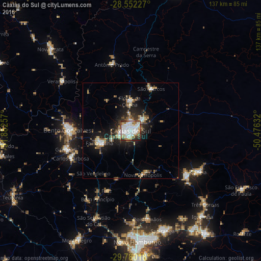
Analysis of Caxias do Sul night lights 2016
Square area 10x10 km:
 34.72%
90-99
28.57%80-89
6.94%70-79
5.95%60-69
7.94%50-59
6.75%40-49
1.19%30-39
4.56%20-29
2.98%10-19
0.4%0-9
0%Square area 50x50 km:
1.95%90-99
1.94%80-89
1.32%70-79
1.12%60-69
1.35%50-59
2.02%40-49
1.01%30-39
2.04%20-29
2.72%10-19
7.81%0-9
76.72%Clear (daylight) street map image can be seen on geolist.org.
Map coordinates:
28° 33' 8.2" South, 51° 52' 57.3" West
29° 10' 5" South, 51° 10' 46" West
29° 46' 48.6" South, 50° 28' 34.8" West
Some cities around Caxias do Sul sort by population:
• Bento Gonçalves
33 km =20.5 mi,  269°
269°
• Farroupilha
17.5 km =10.9 mi,  248°
248°
• Canela
41.2 km =25.6 mi,  120°
120°
• Garibaldi
35.7 km =22.2 mi, 254°
• Flores da Cunha
15.5 km =9.6 mi,  359°
359°
• Carlos Barbosa
34.6 km =21.5 mi, 245°
• São Marcos
24.4 km =15.2 mi,  26°
26°
• Nova Petrópolis
24 km =14.9 mi,  164°
164°
3466537 (p: 381,270)
Sources (retrieved 2019-11-25):
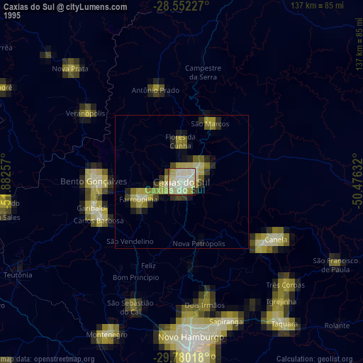
» NASA, Earths city lights 1995
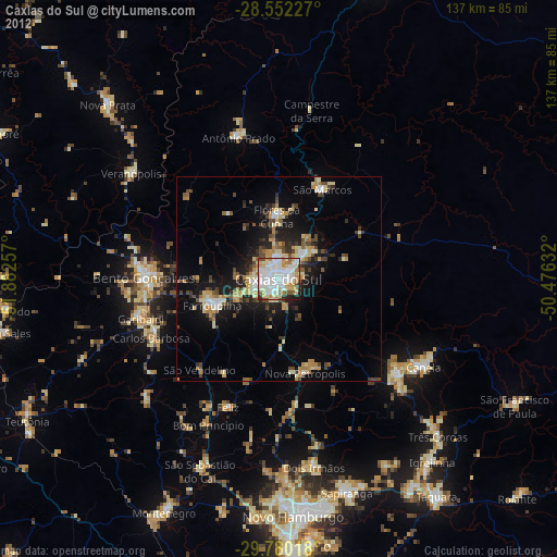
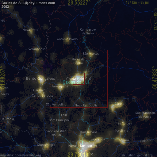
» NASA city lights 2003
» Earth at Night: Flat Maps 2012, 2016