Cariré night lights from space
Night Light of Cariré (Ceará) from space (Brazil) Src. Average luminocity for 10x10km area is 6.2359% and for 50x50km: 3.7813%.
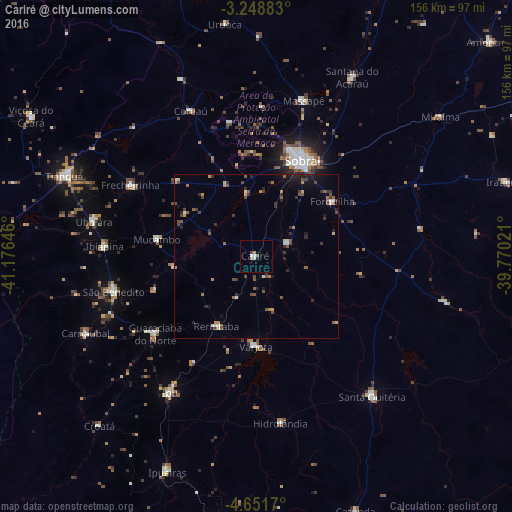
Analysis of Cariré night lights 2016
Square area 10x10 km:
 0.65%
0.65%90-99
1.95%80-89
0%70-79
1.08%60-69
0.65%50-59
0.87%40-49
0.65%30-39
0.22%20-29
0.22%10-19
0.65%0-9
93.07%Square area 50x50 km:
0.16%90-99
0.43%80-89
0.24%70-79
0.41%60-69
0.47%50-59
0.74%40-49
0.95%30-39
0.82%20-29
1.03%10-19
1.58%0-9
93.18%Clear (daylight) street map image can be seen on geolist.org.
Map coordinates:
3° 14' 55.8" South, 41° 10' 35.3" West
3° 57' 2" South, 40° 28' 24" West
4° 39' 6.1" South, 39° 46' 12.8" West
Some cities around Cariré sort by population:
• Sobral
32.4 km =20.1 mi,  25°
25°
• Ipu
49 km =30.4 mi,  212°
212°
• Guaraciaba do Norte
38.8 km =24.1 mi,  231°
231°
• Varjota
27.1 km =16.8 mi,  180°
180°
• Forquilha
29 km =18 mi,  54°
54°
• Coreaú
50.7 km =31.5 mi,  336°
336°
• Reriutaba
24.4 km =15.2 mi, 209°
• Ibiapina
46.3 km =28.8 mi,  273°
273°
3402893 (p: 5,488)
Sources (retrieved 2019-11-25):
» Earth at Night: Flat Maps 2012, 2016