Guaraciaba do Norte night lights from space
Night Light of Guaraciaba do Norte (Ceará) from space (Brazil) Src. Average luminocity for 10x10km area is 11.4762% and for 50x50km: 5.0637%.
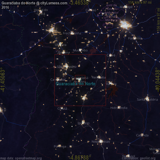
Analysis of Guaraciaba do Norte night lights 2016
Square area 10x10 km:
 1.73%
1.73%90-99
2.38%80-89
1.95%70-79
0.87%60-69
0%50-59
2.6%40-49
1.52%30-39
0.22%20-29
1.73%10-19
0%0-9
87.01%Square area 50x50 km:
0.27%90-99
0.82%80-89
0.53%70-79
0.62%60-69
0.64%50-59
0.73%40-49
0.87%30-39
0.69%20-29
1.11%10-19
1.78%0-9
91.94%Clear (daylight) street map image can be seen on geolist.org.
Map coordinates:
3° 27' 55.4" South, 41° 27' 2.3" West
4° 10' 1" South, 40° 44' 51" West
4° 52' 4.4" South, 40° 2' 39.8" West
Some cities around Guaraciaba do Norte sort by population:
• Tianguá
55.4 km =34.4 mi,  330°
330°
• Ipu
17.7 km =11 mi,  166°
166°
• Varjota
30.2 km =18.8 mi,  95°
95°
• Ubajara
39.7 km =24.7 mi, 331°
• Reriutaba
18.5 km =11.5 mi,  81°
81°
• Hidrolândia
43.6 km =27.1 mi,  127°
127°
• Ibiapina
31.3 km =19.4 mi, 329°
• Cariré
38.8 km =24.1 mi,  51°
51°
3398569 (p: 18,186)
Sources (retrieved 2019-11-25):
» Earth at Night: Flat Maps 2012, 2016