Cafelândia night lights from space
Night Light of Cafelândia (São Paulo) from space (Brazil) Src. Average luminocity for 10x10km area is 9.131% and for 50x50km: 4.0893%.
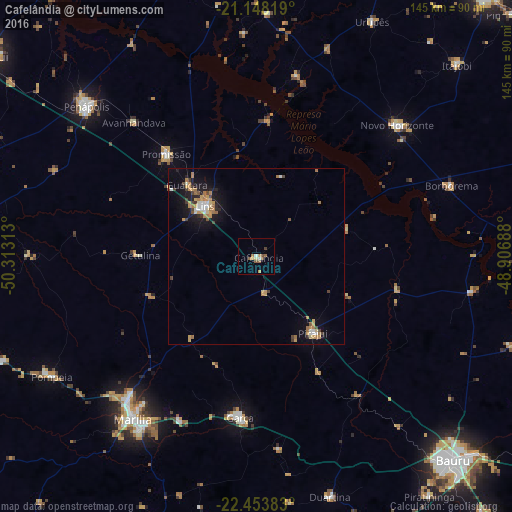
Analysis of Cafelândia night lights 2016
Square area 10x10 km:
 0.6%
0.6%90-99
0.99%80-89
0.79%70-79
1.79%60-69
1.39%50-59
3.97%40-49
1.59%30-39
0%20-29
0%10-19
0%0-9
88.89%Square area 50x50 km:
0.34%90-99
0.42%80-89
0.3%70-79
1.13%60-69
0.88%50-59
0.37%40-49
0.59%30-39
0.33%20-29
0.56%10-19
2.86%0-9
92.23%Clear (daylight) street map image can be seen on geolist.org.
Map coordinates:
21° 8' 53.5" South, 50° 18' 47.3" West
21° 48' 9" South, 49° 36' 36" West
22° 27' 13.8" South, 48° 54' 24.8" West
Some cities around Cafelândia sort by population:
• Marília
57.4 km =35.7 mi,  217°
217°
• Lins
19.4 km =12.1 mi,  315°
315°
• Penápolis
64.4 km =40 mi,  311°
311°
• Garça
45.6 km =28.3 mi,  185°
185°
• Novo Horizonte
54.8 km =34.1 mi,  47°
47°
• Promissão
39.1 km =24.3 mi, 319°
• Pirajuí
26.9 km =16.7 mi,  144°
144°
• Borborema
59 km =36.7 mi,  69°
69°
3468296 (p: 13,777)
Sources (retrieved 2019-11-25):
» Earth at Night: Flat Maps 2012, 2016