Novo Horizonte night lights from space
Night Light of Novo Horizonte (São Paulo) from space (Brazil) Src. Average luminocity for 10x10km area is 20.7083% and for 50x50km: 2.1394%.
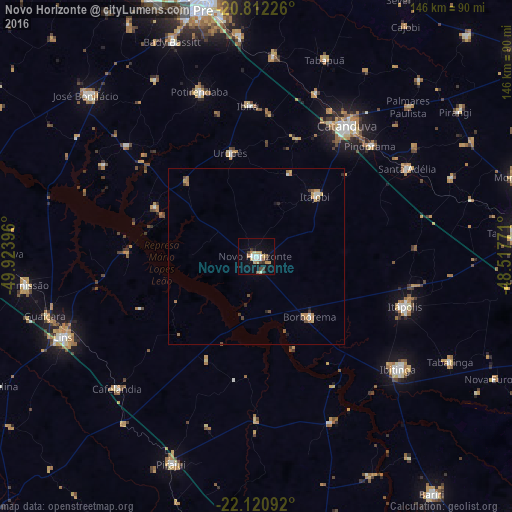
Analysis of Novo Horizonte night lights 2016
Square area 10x10 km:
 3.03%
3.03%90-99
2.65%80-89
2.65%70-79
4.92%60-69
2.08%50-59
1.33%40-49
2.84%30-39
2.08%20-29
1.52%10-19
12.12%0-9
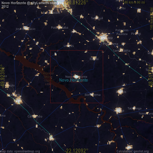
64.77%Square area 50x50 km:
0.18%90-99
0.25%80-89
0.18%70-79
0.53%60-69
0.41%50-59
0.14%40-49
0.36%30-39
0.2%20-29
0.2%10-19
0.64%0-9
96.9%Clear (daylight) street map image can be seen on geolist.org.
Map coordinates:
20° 48' 44.1" South, 49° 55' 26.3" West
21° 28' 5" South, 49° 13' 15" West
22° 7' 15.3" South, 48° 31' 3.8" West
Some cities around Novo Horizonte sort by population:
• Catanduva
44.8 km =27.8 mi,  34°
34°
• Ibitinga
51.8 km =32.2 mi,  128°
128°
• Itápolis
44.5 km =27.7 mi,  108°
108°
• Santa Adélia
49.9 km =31 mi,  59°
59°
• Pindorama
45.2 km =28.1 mi,  45°
45°
• Itajobi
24 km =14.9 mi, 45°
• Borborema
22.7 km =14.1 mi,  137°
137°
• Urupês
30.5 km =19 mi,  346°
346°
3456060 (p: 30,158)
Sources (retrieved 2019-11-25):
» Earth at Night: Flat Maps 2012, 2016