Cachoeirinha night lights from space
Night Light of Cachoeirinha (Pernambuco) from space (Brazil) Src. Average luminocity for 10x10km area is 5.9029% and for 50x50km: 4.3835%.
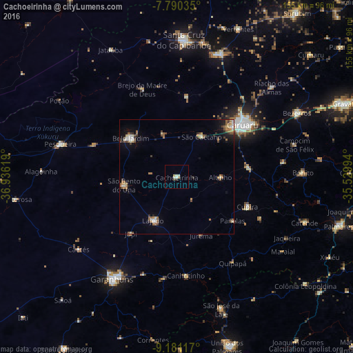
Analysis of Cachoeirinha night lights 2016
Square area 10x10 km:
 0%
0%90-99
3.31%80-89
0.41%70-79
0.62%60-69
0.62%50-59
0%40-49
0.83%30-39
0.83%20-29
0%10-19
0%0-9
93.39%Square area 50x50 km:
0.25%90-99
0.93%80-89
0.32%70-79
0.51%60-69
0.88%50-59
0.79%40-49
0.61%30-39
0.69%20-29
0.48%10-19
1.76%0-9
92.77%Clear (daylight) street map image can be seen on geolist.org.
Map coordinates:
7° 47' 25.3" South, 36° 56' 10.3" West
8° 29' 11" South, 36° 13' 59" West
9° 10' 52.2" South, 35° 31' 47.8" West
Some cities around Cachoeirinha sort by population:
• Caruaru
36.2 km =22.5 mi,  51°
51°
• Belo Jardim
26.9 km =16.7 mi,  308°
308°
• Brejo da Madre de Deus
40.8 km =25.4 mi,  338°
338°
• Lajedo
21.9 km =13.6 mi,  205°
205°
• Cupira
34.3 km =21.3 mi,  114°
114°
• Agrestina
31.9 km =19.8 mi,  84°
84°
• Canhotinho
44.3 km =27.5 mi,  174°
174°
• Altinho
19.1 km =11.9 mi,  91°
91°
3404355 (p: 12,905)
Sources (retrieved 2019-11-25):
» Earth at Night: Flat Maps 2012, 2016