Belo Jardim night lights from space
Night Light of Belo Jardim (Pernambuco) from space (Brazil) Src. Average luminocity for 10x10km area is 23.4876% and for 50x50km: 2.4905%.
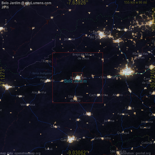
Analysis of Belo Jardim night lights 2016
Square area 10x10 km:
 2.48%
2.48%90-99
8.26%80-89
1.45%70-79
0.21%60-69
1.24%50-59
4.75%40-49
2.89%30-39
4.34%20-29
1.65%10-19
15.08%0-9
57.64%Square area 50x50 km:
0.14%90-99
0.56%80-89
0.2%70-79
0.26%60-69
0.42%50-59
0.43%40-49
0.33%30-39
0.44%20-29
0.32%10-19
0.68%0-9
96.21%Clear (daylight) street map image can be seen on geolist.org.
Map coordinates:
7° 38' 21.3" South, 37° 7' 38.3" West
8° 20' 8" South, 36° 25' 27" West
9° 1' 50.2" South, 35° 43' 15.8" West
Some cities around Belo Jardim sort by population:
• Caruaru
49.6 km =30.8 mi,  83°
83°
• Santa Cruz do Capibaribe
48.5 km =30.1 mi,  29°
29°
• Pesqueira
30 km =18.6 mi,  265°
265°
• Brejo da Madre de Deus
21.9 km =13.6 mi,  15°
15°
• Lajedo
38.2 km =23.7 mi,  162°
162°
• Cachoeirinha
26.9 km =16.7 mi,  128°
128°
• Altinho
43.6 km =27.1 mi,  113°
113°
• Caetés
53.3 km =33.1 mi,  204°
204°
3405812 (p: 49,922)
Sources (retrieved 2019-11-25):
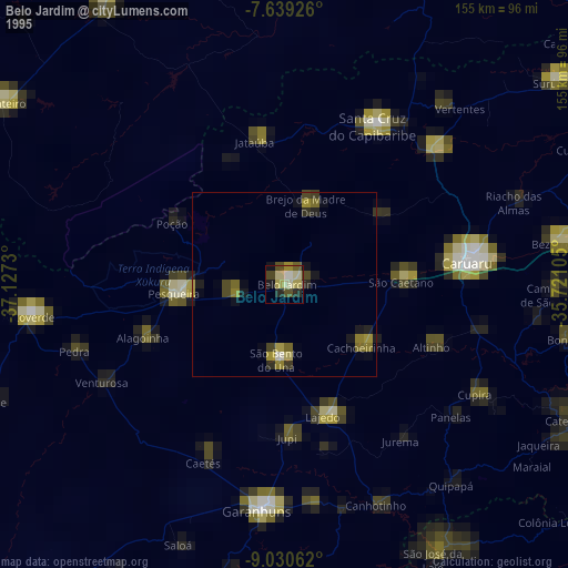
» NASA, Earths city lights 1995
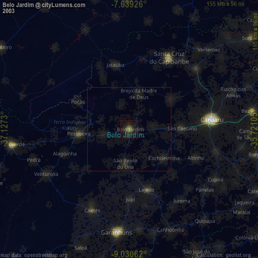
» NASA city lights 2003
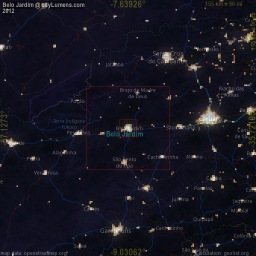
» Earth at Night: Flat Maps 2012, 2016