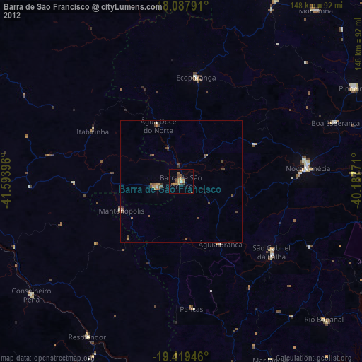
Barra de São Francisco night lights from space
Night Light of Barra de São Francisco (Espírito Santo) from space (Brazil) Src. Average luminocity for 10x10km area is 16.9112% and for 50x50km: 2.3324%.
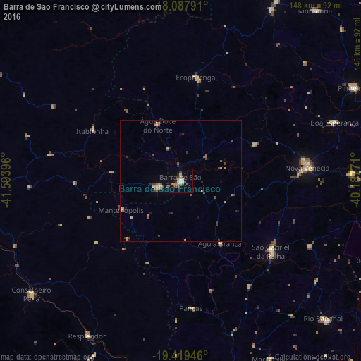
Analysis of Barra de São Francisco night lights 2016
Square area 10x10 km:
 1.86%
1.86%90-99
1.45%80-89
2.48%70-79
3.93%60-69
1.03%50-59
1.65%40-49
2.48%30-39
3.51%20-29
1.65%10-19
4.13%0-9
75.83%Square area 50x50 km:
0.09%90-99
0.17%80-89
0.4%70-79
0.41%60-69
0.29%50-59
0.42%40-49
0.46%30-39
0.46%20-29
0.37%10-19
0.51%0-9
96.4%Clear (daylight) street map image can be seen on geolist.org.
Map coordinates:
18° 5' 16.5" South, 41° 35' 38.3" West
18° 45' 18" South, 40° 53' 27" West
19° 25' 10.1" South, 40° 11' 15.8" West
Some cities around Barra de São Francisco sort by population:
• Nova Venécia
51.9 km =32.2 mi,  84°
84°
• Resplendor
74.1 km =46 mi,  211°
211°
• Ecoporanga
42.9 km =26.7 mi,  8°
8°
• Conselheiro Pena
76.7 km =47.7 mi,  232°
232°
• Boa Esperança
67.1 km =41.7 mi,  69°
69°
• Divino das Laranjeiras
62 km =38.5 mi,  267°
267°
• Mantenópolis
27.2 km =16.9 mi,  243°
243°
• Pancas
52.4 km =32.6 mi,  175°
175°
3470730 (p: 20,743)
Sources (retrieved 2019-11-25):
» Earth at Night: Flat Maps 2012, 2016