Luzilândia night lights from space
Night Light of Luzilândia (Piauí) from space (Brazil) Src. Average luminocity for 10x10km area is 15.1082% and for 50x50km: 3.5387%.
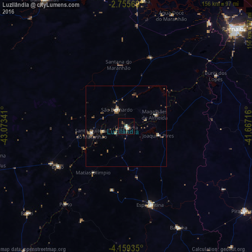
Analysis of Luzilândia night lights 2016
Square area 10x10 km:
 1.08%
1.08%90-99
3.68%80-89
1.3%70-79
1.73%60-69
0.87%50-59
3.03%40-49
1.95%30-39
2.81%20-29
0.87%10-19
1.73%0-9
80.95%Square area 50x50 km:
0.17%90-99
0.59%80-89
0.2%70-79
0.33%60-69
0.71%50-59
0.78%40-49
0.54%30-39
0.67%20-29
0.63%10-19
0.45%0-9
94.94%Clear (daylight) street map image can be seen on geolist.org.
Map coordinates:
2° 45' 20.5" South, 43° 4' 24.3" West
3° 27' 28" South, 42° 22' 13" West
4° 9' 33.7" South, 41° 40' 1.8" West
Some cities around Luzilândia sort by population:
• Esperantina
51.6 km =32.1 mi,  162°
162°
• Santa Quitéria do Maranhão
20.6 km =12.8 mi,  251°
251°
• Tutóia
78.1 km =48.5 mi,  7°
7°
• Brejo
49.1 km =30.5 mi,  239°
239°
• São Bernardo
11.9 km =7.4 mi,  333°
333°
• Buriti dos Lopes
64.1 km =39.8 mi,  60°
60°
• Batalha
71.1 km =44.2 mi,  152°
152°
• Porto
61.4 km =38.2 mi,  217°
217°
3396101 (p: 12,999)
Sources (retrieved 2019-11-25):
» Earth at Night: Flat Maps 2012, 2016