Kétou night lights from space
Night Light of Kétou (Plateau) from space (Benin) Src. Average luminocity for 10x10km area is 0.7706% and for 50x50km: 0.3109%.
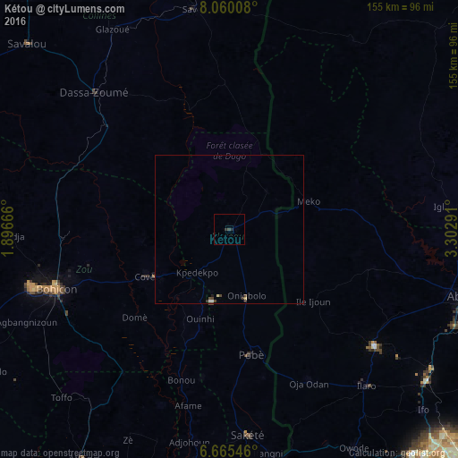
Analysis of Kétou night lights 2016
Square area 10x10 km:
100  0%
0%
90-99 0%
80-89 0%
70-79 0%
60-69 0%
50-59 0%
40-49 0%
30-39 0.87%
20-29 1.52%
10-19 0.22%
0-9 97.4%
0%90-99
0%80-89
0%70-79
0%60-69
0%50-59
0%40-49
0%30-39
0.87%20-29
1.52%10-19
0.22%0-9
97.4%Square area 50x50 km:
100 0.03%
90-99 0.03%
80-89 0.07%
70-79 0%
60-69 0%
50-59 0%
40-49 0.19%
30-39 0.15%
20-29 0.06%
10-19 0.04%
0-9 99.42%
0.03%90-99
0.03%80-89
0.07%70-79
0%60-69
0%50-59
0%40-49
0.19%30-39
0.15%20-29
0.06%10-19
0.04%0-9
99.42%Clear (daylight) street map image can be seen on geolist.org.
Map coordinates:
8° 3' 36.3" North, 1° 53' 48" East
7° 21' 48" North, 2° 35' 59.2" East
6° 39' 55.7" North, 3° 18' 10.5" East
Some cities around Kétou sort by population:
• Bohicon
62.3 km =38.7 mi,  250°
250°
• Abomey
70.1 km =43.6 mi, 253°
• Ilaro, NG
69.8 km =43.4 mi,  139°
139°
• Cové
32.7 km =20.3 mi,  241°
241°
• Pobé
43.2 km =26.8 mi,  170°
170°
• Sakété
70 km =43.5 mi, 174°
• Dassa-Zoumé
62.9 km =39.1 mi,  313°
313°
• Imeko, NG
28.4 km =17.6 mi,  70°
70°
2393551 (p: 22,341)
Sources (retrieved 2019-11-25):
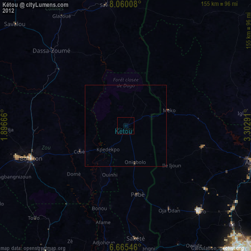
» Earth at Night: Flat Maps 2012, 2016