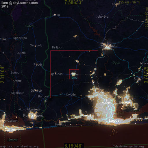
Ilaro night lights from space
Night Light of Ilaro (Ogun) from space (Nigeria) Src. Average luminocity for 10x10km area is 1.1429% and for 50x50km: 3.4842%.
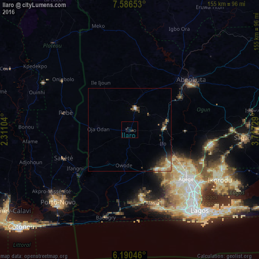
Analysis of Ilaro night lights 2016
Square area 10x10 km:
100  0%
0%
90-99 0%
80-89 0%
70-79 0%
60-69 0%
50-59 0%
40-49 0.87%
30-39 0%
20-29 2.6%
10-19 0%
0-9 96.54%
0%90-99
0%80-89
0%70-79
0%60-69
0%50-59
0%40-49
0.87%30-39
0%20-29
2.6%10-19
0%0-9
96.54%Square area 50x50 km:
100 0.16%
90-99 0.46%
80-89 0.56%
70-79 0.56%
60-69 0.58%
50-59 0.39%
40-49 0.78%
30-39 1.09%
20-29 0.62%
10-19 1.37%
0-9 93.43%
0.16%90-99
0.46%80-89
0.56%70-79
0.56%60-69
0.58%50-59
0.39%40-49
0.78%30-39
1.09%20-29
0.62%10-19
1.37%0-9
93.43%Clear (daylight) street map image can be seen on geolist.org.
Map coordinates:
7° 35' 11.5" North, 2° 18' 39.7" East
6° 53' 20.4" North, 3° 0' 51" East
6° 11' 25.7" North, 3° 43' 2.2" East
Some cities around Ilaro sort by population:
• Abeokuta
47 km =29.2 mi,  50°
50°
• Ikeja
48.7 km =30.3 mi,  131°
131°
• Ifo
21.6 km =13.4 mi,  112°
112°
• Pobé, BJ
39.9 km =24.8 mi,  284°
284°
• Sakété, BJ
42.8 km =26.6 mi,  246°
246°
• Ado-Odo
33.6 km =20.9 mi,  193°
193°
• Owode
54.6 km =33.9 mi,  83°
83°
• Idiroko
41.1 km =25.5 mi,  225°
225°
2337759 (p: 46,999)
Sources (retrieved 2019-11-25):
» Earth at Night: Flat Maps 2012, 2016