Abomey night lights from space
Night Light of Abomey (Zou) from space (Benin) Src. Average luminocity for 10x10km area is 18.4026% and for 50x50km: 1.689%.
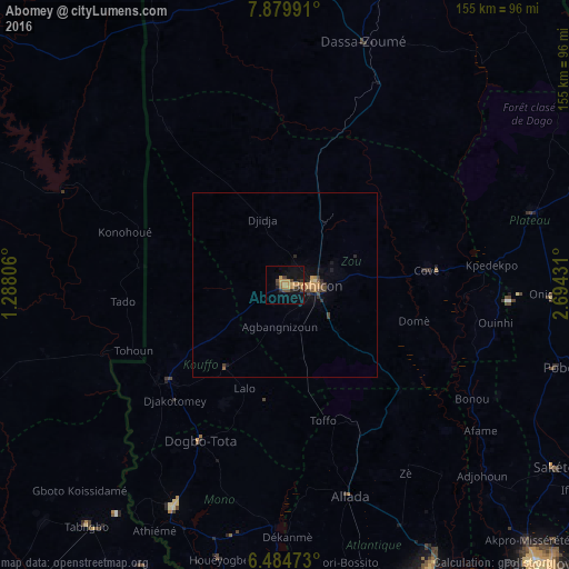
Analysis of Abomey night lights 2016
Square area 10x10 km:
 0%
0%90-99
0%80-89
1.3%70-79
7.79%60-69
4.11%50-59
0.87%40-49
4.11%30-39
3.9%20-29
3.46%10-19
14.5%0-9
59.96%Square area 50x50 km:
0%90-99
0%80-89
0.11%70-79
0.6%60-69
0.34%50-59
0.16%40-49
0.42%30-39
0.42%20-29
0.33%10-19
1.13%0-9
96.5%Clear (daylight) street map image can be seen on geolist.org.
Map coordinates:
7° 52' 47.7" North, 1° 17' 17" East
7° 10' 58.3" North, 1° 59' 28.3" East
6° 29' 5" North, 2° 41' 39.5" East
Some cities around Abomey sort by population:
• Bohicon
8.3 km =5.2 mi,  93°
93°
• Lokossa
67.7 km =42.1 mi,  206°
206°
• Dogbo
48.6 km =30.2 mi, 208°
• Cové
38.7 km =24 mi,  83°
83°
• Kétou
70.1 km =43.6 mi,  73°
73°
• Dassa-Zoumé
66.5 km =41.3 mi,  18°
18°
• Allada
60.2 km =37.4 mi,  162°
162°
• Aplahoué
43.9 km =27.3 mi,  230°
230°
2395915 (p: 82,154)
Sources (retrieved 2019-11-25):
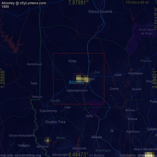
» NASA, Earths city lights 1995
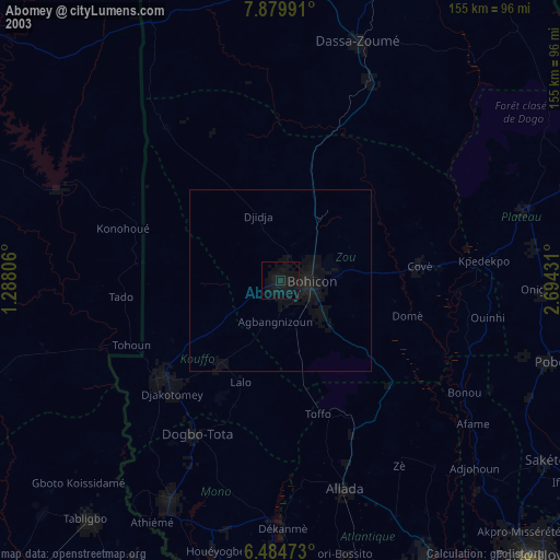
» NASA city lights 2003
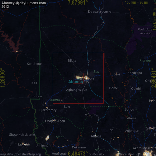
» Earth at Night: Flat Maps 2012, 2016