Cové night lights from space
Night Light of Cové (Zou) from space (Benin) Src. Average luminocity for 10x10km area is 1.4589% and for 50x50km: 0.2782%.

Analysis of Cové night lights 2016
Square area 10x10 km:
100  0%
0%
90-99 0%
80-89 0%
70-79 0%
60-69 0.22%
50-59 0.65%
40-49 0%
30-39 0.87%
20-29 1.73%
10-19 0.87%
0-9 95.67%
0%90-99
0%80-89
0%70-79
0%60-69
0.22%50-59
0.65%40-49
0%30-39
0.87%20-29
1.73%10-19
0.87%0-9
95.67%Square area 50x50 km:
100 0.03%
90-99 0.03%
80-89 0.02%
70-79 0%
60-69 0.01%
50-59 0.03%
40-49 0.16%
30-39 0.09%
20-29 0.1%
10-19 0.07%
0-9 99.46%
0.03%90-99
0.03%80-89
0.02%70-79
0%60-69
0.01%50-59
0.03%40-49
0.16%30-39
0.09%20-29
0.1%10-19
0.07%0-9
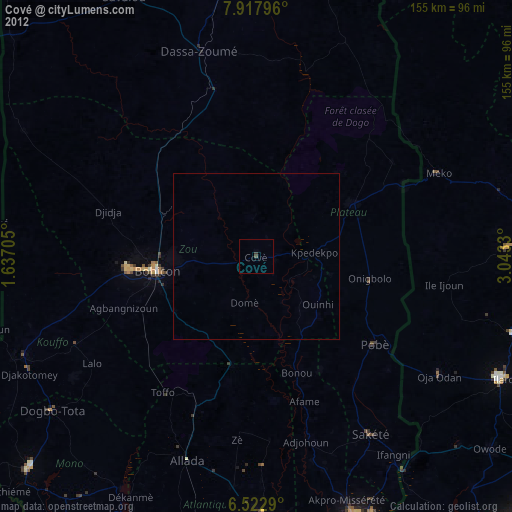
99.46%Clear (daylight) street map image can be seen on geolist.org.
Map coordinates:
7° 55' 4.7" North, 1° 38' 13.4" East
7° 13' 15.5" North, 2° 20' 24.6" East
6° 31' 22.4" North, 3° 2' 35.9" East
Some cities around Cové sort by population:
• Bohicon
30.5 km =19 mi,  261°
261°
• Abomey
38.7 km =24 mi, 263°
• Pobé
44.7 km =27.8 mi,  126°
126°
• Sakété
64.4 km =40 mi,  146°
146°
• Kétou
32.7 km =20.3 mi,  61°
61°
• Dassa-Zoumé
61.3 km =38.1 mi,  343°
343°
• Allada
65.2 km =40.5 mi,  198°
198°
• Imeko, NG
61 km =37.9 mi,  65°
65°
2394814 (p: 38,566)
Sources (retrieved 2019-11-25):
» Earth at Night: Flat Maps 2012, 2016