Allada night lights from space
Night Light of Allada (Atlantique) from space (Benin) Src. Average luminocity for 10x10km area is 0.9416% and for 50x50km: 1.6875%.
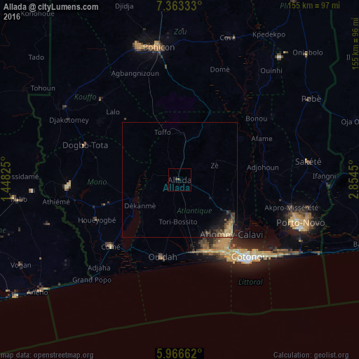
Analysis of Allada night lights 2016
Square area 10x10 km:
 0%
0%90-99
0%80-89
0%70-79
0%60-69
0.87%50-59
0%40-49
0%30-39
0.87%20-29
0%10-19
0%0-9
98.27%Square area 50x50 km:
0%90-99
0.02%80-89
0.4%70-79
0.32%60-69
0.19%50-59
0.32%40-49
0.35%30-39
0.56%20-29
0.55%10-19
1.45%0-9
95.85%Clear (daylight) street map image can be seen on geolist.org.
Map coordinates:
7° 21' 48" North, 1° 26' 53.7" East
6° 39' 55.7" North, 2° 9' 5" East
5° 57' 59.8" North, 2° 51' 16.2" East
Some cities around Allada sort by population:
• Cotonou
44.5 km =27.7 mi,  138°
138°
• Abomey-Calavi
33 km =20.5 mi, 136°
• Porto-Novo
53.4 km =33.2 mi,  110°
110°
• Lokossa
48.1 km =29.9 mi,  266°
266°
• Ouidah
34.4 km =21.4 mi,  192°
192°
• Dogbo
43.5 km =27 mi,  289°
289°
• Comé
41.3 km =25.7 mi,  226°
226°
• Hévié
29.7 km =18.5 mi,  158°
158°
2395635 (p: 20,094)
Sources (retrieved 2019-11-25):
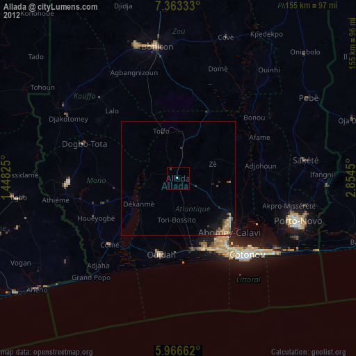
» Earth at Night: Flat Maps 2012, 2016