Goulouré night lights from space
Night Light of Goulouré (Centre-Ouest) from space (Burkina Faso) Src. Average luminocity for 10x10km area is 0% and for 50x50km: 0.0936%.
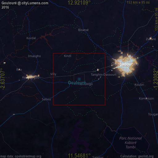
Analysis of Goulouré night lights 2016
Square area 10x10 km:
 0%
0%90-99
0%80-89
0%70-79
0%60-69
0%50-59
0%40-49
0%30-39
0%20-29
0%10-19
0%0-9
100%Square area 50x50 km:
0%90-99
0%80-89
0.03%70-79
0%60-69
0.01%50-59
0.03%40-49
0%30-39
0.05%20-29
0.08%10-19
0%0-9
99.8%Clear (daylight) street map image can be seen on geolist.org.
Map coordinates:
12° 55' 15.9" North, 2° 38' 13.5" West
12° 14' 5.4" North, 1° 56' 2.2" West
11° 32' 48.5" North, 1° 13' 51" West
Some cities around Goulouré sort by population:
• Ouagadougou
45.8 km =28.5 mi,  71°
71°
• Koudougou
46.6 km =29 mi,  272°
272°
• Réo
59.1 km =36.7 mi,  279°
279°
• Kombissiri
67.5 km =41.9 mi,  105°
105°
• Kokologo
7.7 km =4.8 mi,  126°
126°
• Boussé
47.6 km =29.6 mi,  5°
5°
• Ziniaré
79.2 km =49.2 mi,  60°
60°
• Pitmoaga
5.8 km =3.6 mi,  78°
78°
2360286 (p: 6,677)
Sources (retrieved 2019-11-25):
» Earth at Night: Flat Maps 2012, 2016