Tournai night lights from space
Night Light of Tournai (Wallonia) from space (Belgium) Src. Average luminocity for 10x10km area is 52.7166% and for 50x50km: 37.5283%.
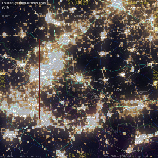
Analysis of Tournai night lights 2016
Square area 10x10 km:
 8.96%
8.96%90-99
10.43%80-89
7.09%70-79
4.81%60-69
8.82%50-59
7.22%40-49
6.28%30-39
10.7%20-29
26.74%10-19
8.96%0-9
0%Square area 50x50 km:
8.99%90-99
6.58%80-89
2.85%70-79
3.8%60-69
4.97%50-59
5%40-49
5.27%30-39
5.65%20-29
11.67%10-19
20.46%0-9
24.75%Clear (daylight) street map image can be seen on geolist.org.
Map coordinates:
51° 3' 4.5" North, 2° 41' 10.3" East
50° 36' 25.7" North, 3° 23' 21.6" East
50° 9' 31.7" North, 4° 5' 32.8" East
Some cities around Tournai sort by population:
• Villeneuve-d'Ascq, FR
15.7 km =9.8 mi,  273°
273°
• Hem, FR
15.1 km =9.4 mi,  289°
289°
• Lys-lez-Lannoy, FR
13.9 km =8.6 mi,  298°
298°
• Leers, FR
13.2 km =8.2 mi,  309°
309°
• Estaimpuis
13.8 km =8.6 mi,  321°
321°
• Antoing
6.1 km =3.8 mi,  136°
136°
• Celles
12.6 km =7.8 mi,  22°
22°
• Pecq
9.5 km =5.9 mi,  337°
337°
2785341 (p: 67,721)
Sources (retrieved 2019-11-25):
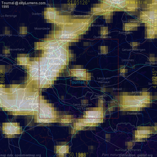
» NASA, Earths city lights 1995
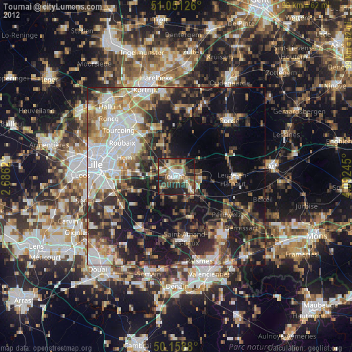
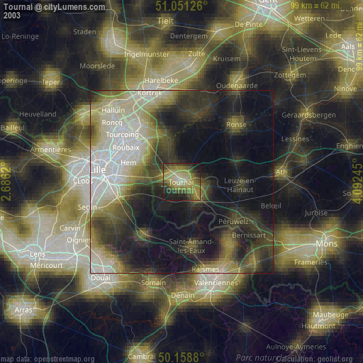
» NASA city lights 2003
» Earth at Night: Flat Maps 2012, 2016