Antoing night lights from space
Night Light of Antoing (Wallonia) from space (Belgium) Src. Average luminocity for 10x10km area is 40.2246% and for 50x50km: 34.6331%.
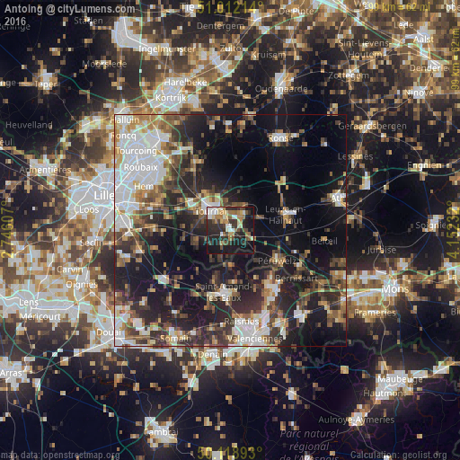
Analysis of Antoing night lights 2016
Square area 10x10 km:
 5.21%
5.21%90-99
6.82%80-89
4.95%70-79
2.14%60-69
9.89%50-59
3.21%40-49
5.88%30-39
7.09%20-29
21.39%10-19
28.61%0-9
4.81%Square area 50x50 km:
7.38%90-99
5.86%80-89
2.83%70-79
3.29%60-69
4.31%50-59
4.9%40-49
5.41%30-39
5.76%20-29
11.74%10-19
20.38%0-9
28.14%Clear (daylight) street map image can be seen on geolist.org.
Map coordinates:
51° 0' 43.7" North, 2° 44' 45.9" East
50° 34' 3.5" North, 3° 26' 57.1" East
50° 7' 8.1" North, 4° 9' 8.4" East
Some cities around Antoing sort by population:
• Tournai
6.1 km =3.8 mi,  316°
316°
• Saint-Amand-les-Eaux, FR
13.5 km =8.4 mi,  185°
185°
• Péruwelz
12.2 km =7.6 mi,  122°
122°
• Frasnes-lez-Buissenal
16.4 km =10.2 mi,  47°
47°
• Vieux-Condé, FR
14.6 km =9.1 mi,  145°
145°
• Condé-sur-l’Escaut, FR
16 km =9.9 mi,  141°
141°
• Celles
16.1 km =10 mi,  2°
2°
• Pecq
15.3 km =9.5 mi,  329°
329°
2803144 (p: 7,507)
Sources (retrieved 2019-11-25):
» Earth at Night: Flat Maps 2012, 2016