Celles night lights from space
Night Light of Celles (Wallonia) from space (Belgium) Src. Average luminocity for 10x10km area is 3.7206% and for 50x50km: 35.0751%.
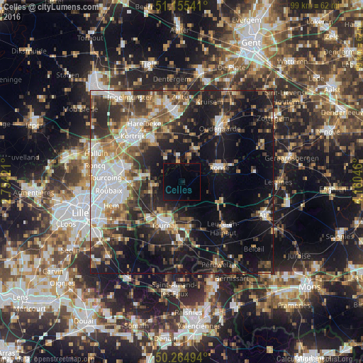
Analysis of Celles night lights 2016
Square area 10x10 km:
 0%
0%90-99
0%80-89
0%70-79
0%60-69
0%50-59
0%40-49
0%30-39
0%20-29
1.6%10-19
6.15%0-9
92.25%Square area 50x50 km:
7.14%90-99
5.92%80-89
3.11%70-79
3.77%60-69
4.59%50-59
5.46%40-49
5.38%30-39
5.91%20-29
10.45%10-19
19.34%0-9
28.93%Clear (daylight) street map image can be seen on geolist.org.
Map coordinates:
51° 9' 19.5" North, 2° 45' 15.2" East
50° 42' 44.2" North, 3° 27' 26.4" East
50° 15' 53.8" North, 4° 9' 37.7" East
Some cities around Celles sort by population:
• Tournai
12.6 km =7.8 mi,  202°
202°
• Ronse
10.7 km =6.6 mi,  69°
69°
• Zwevegem
13.9 km =8.6 mi,  323°
323°
• Anzegem
13.9 km =8.6 mi,  5°
5°
• Frasnes-lez-Buissenal
12.5 km =7.8 mi,  113°
113°
• Estaimpuis
13.4 km =8.3 mi,  266°
266°
• Avelgem
7.2 km =4.5 mi,  353°
353°
• Pecq
8.9 km =5.5 mi,  250°
250°
2800605 (p: 5,471)
Sources (retrieved 2019-11-25):
» Earth at Night: Flat Maps 2012, 2016