Soignies night lights from space
Night Light of Soignies (Wallonia) from space (Belgium) Src. Average luminocity for 10x10km area is 20.008% and for 50x50km: 35.2633%.
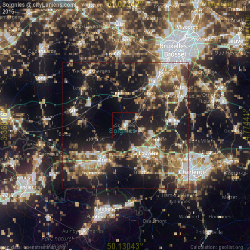
Analysis of Soignies night lights 2016
Square area 10x10 km:
 2.41%
2.41%90-99
2.81%80-89
0.4%70-79
1.2%60-69
3.88%50-59
1.34%40-49
3.74%30-39
2.54%20-29
2.01%10-19
39.44%0-9
40.24%Square area 50x50 km:
3.92%90-99
5.47%80-89
3.68%70-79
5.08%60-69
5.84%50-59
6.45%40-49
5.81%30-39
6.91%20-29
11.05%10-19
23.54%0-9
22.25%Clear (daylight) street map image can be seen on geolist.org.
Map coordinates:
51° 1' 24.3" North, 3° 22' 5.4" East
50° 34' 44.5" North, 4° 4' 16.6" East
50° 7' 49.5" North, 4° 46' 27.9" East
Some cities around Soignies sort by population:
• La Louvière
13.2 km =8.2 mi,  141°
141°
• Braine-le-Comte
6.3 km =3.9 mi,  57°
57°
• Enghien
12 km =7.5 mi,  346°
346°
• Rebecq-Rognon
8.4 km =5.2 mi,  17°
17°
• Écaussinnes-d’Enghien
6.8 km =4.2 mi,  100°
100°
• Jurbise
12.6 km =7.8 mi,  244°
244°
• Roeulx
8.9 km =5.5 mi,  161°
161°
• Silly
13 km =8.1 mi,  306°
306°
2786420 (p: 24,869)
Sources (retrieved 2019-11-25):
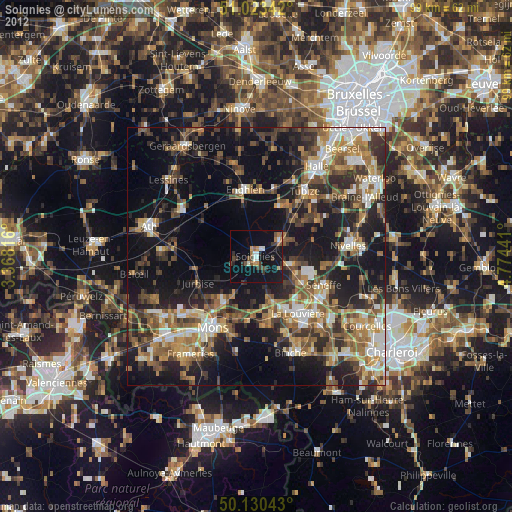
» Earth at Night: Flat Maps 2012, 2016