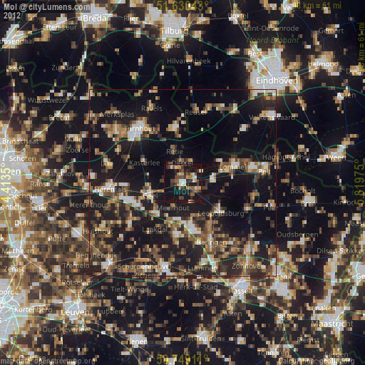
Mol night lights from space
Night Light of Mol (Flanders) from space (Belgium) Src. Average luminocity for 10x10km area is 24.9773% and for 50x50km: 23.8562%.
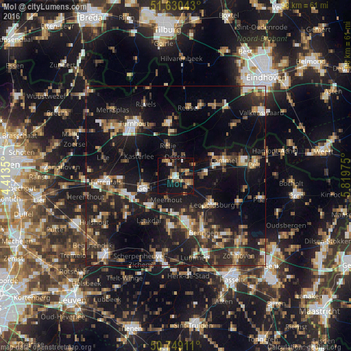
Analysis of Mol night lights 2016
Square area 10x10 km:
 1.74%
1.74%90-99
2.27%80-89
1.87%70-79
4.81%60-69
3.48%50-59
5.35%40-49
3.61%30-39
3.61%20-29
3.21%10-19
41.58%0-9
28.48%Square area 50x50 km:
2.35%90-99
2.95%80-89
1.98%70-79
2.78%60-69
2.95%50-59
3.69%40-49
4.09%30-39
4.42%20-29
10.13%10-19
24.92%0-9
39.75%Clear (daylight) street map image can be seen on geolist.org.
Map coordinates:
51° 37' 49.5" North, 4° 24' 48.6" East
51° 11' 30.8" North, 5° 6' 59.8" East
50° 44' 56.8" North, 5° 49' 11.1" East
Some cities around Mol sort by population:
• Geel
9.4 km =5.8 mi,  251°
251°
• Balen
4.6 km =2.9 mi,  124°
124°
• Kasterlee
11.8 km =7.3 mi,  297°
297°
• Tessenderlo
14.2 km =8.8 mi,  187°
187°
• Leopoldsburg
12.5 km =7.8 mi,  131°
131°
• Retie
8.6 km =5.3 mi,  343°
343°
• Meerhout
7.2 km =4.5 mi,  201°
201°
• Dessel
5.2 km =3.2 mi,  358°
358°
2791067 (p: 32,659)
Sources (retrieved 2019-11-25):
» Earth at Night: Flat Maps 2012, 2016