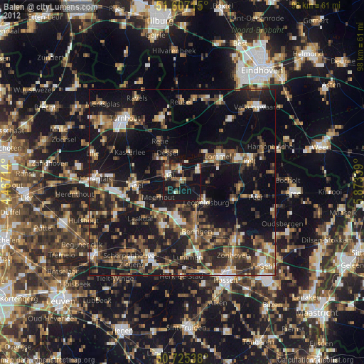
Balen night lights from space
Night Light of Balen (Flanders) from space (Belgium) Src. Average luminocity for 10x10km area is 24.3195% and for 50x50km: 24.459%.
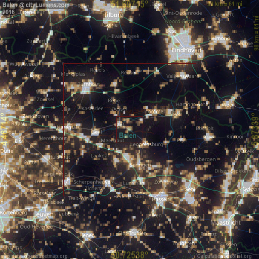
Analysis of Balen night lights 2016
Square area 10x10 km:
100  1.34%
1.34%
90-99 1.87%
80-89 1.6%
70-79 4.28%
60-69 3.21%
50-59 4.01%
40-49 4.28%
30-39 4.55%
20-29 1.87%
10-19 56.42%
0-9 16.58%
1.34%90-99
1.87%80-89
1.6%70-79
4.28%60-69
3.21%50-59
4.01%40-49
4.28%30-39
4.55%20-29
1.87%10-19
56.42%0-9
16.58%Square area 50x50 km:
100 2.52%
90-99 3.15%
80-89 2.06%
70-79 2.85%
60-69 3.05%
50-59 3.74%
40-49 4.32%
30-39 4.2%
20-29 10.03%
10-19 24.68%
0-9 39.38%
2.52%90-99
3.15%80-89
2.06%70-79
2.85%60-69
3.05%50-59
3.74%40-49
4.32%30-39
4.2%20-29
10.03%10-19
24.68%0-9
39.38%Clear (daylight) street map image can be seen on geolist.org.
Map coordinates:
51° 36' 25.7" North, 4° 28' 1.7" East
51° 10' 6.1" North, 5° 10' 13" East
50° 43' 31.4" North, 5° 52' 24.2" East
Some cities around Balen sort by population:
• Geel
12.6 km =7.8 mi,  268°
268°
• Mol
4.6 km =2.9 mi,  304°
304°
• Lommel
12.2 km =7.6 mi,  55°
55°
• Tessenderlo
12.8 km =8 mi,  206°
206°
• Leopoldsburg
8 km =5 mi,  135°
135°
• Retie
12.5 km =7.8 mi,  330°
330°
• Meerhout
7.6 km =4.7 mi,  237°
237°
• Dessel
8.7 km =5.4 mi, 333°
2802743 (p: 19,978)
Sources (retrieved 2019-11-25):
» Earth at Night: Flat Maps 2012, 2016