Dessel night lights from space
Night Light of Dessel (Flanders) from space (Belgium) Src. Average luminocity for 10x10km area is 18.0686% and for 50x50km: 22.0009%.
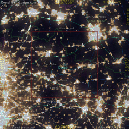
Analysis of Dessel night lights 2016
Square area 10x10 km:
100  1.12%
1.12%
90-99 0.98%
80-89 1.26%
70-79 2.24%
60-69 1.68%
50-59 4.06%
40-49 4.48%
30-39 3.78%
20-29 3.36%
10-19 24.23%
0-9 52.8%
1.12%90-99
0.98%80-89
1.26%70-79
2.24%60-69
1.68%50-59
4.06%40-49
4.48%30-39
3.78%20-29
3.36%10-19
24.23%0-9
52.8%Square area 50x50 km:
100 2.55%
90-99 3.02%
80-89 1.96%
70-79 2.54%
60-69 2.48%
50-59 3.25%
40-49 3.46%
30-39 3.3%
20-29 7.93%
10-19 23.34%
0-9 46.16%
2.55%90-99
3.02%80-89
1.96%70-79
2.54%60-69
2.48%50-59
3.25%40-49
3.46%30-39
3.3%20-29
7.93%10-19
23.34%0-9
46.16%Clear (daylight) street map image can be seen on geolist.org.
Map coordinates:
51° 40' 36" North, 4° 24' 40.9" East
51° 14' 18.8" North, 5° 6' 52.1" East
50° 47' 46.4" North, 5° 49' 3.4" East
Some cities around Dessel sort by population:
• Geel
11.9 km =7.4 mi,  227°
227°
• Mol
5.2 km =3.2 mi,  178°
178°
• Balen
8.7 km =5.4 mi,  153°
153°
• Kasterlee
10.3 km =6.4 mi,  271°
271°
• Oud-Turnhout
12.8 km =8 mi,  314°
314°
• Arendonk
9.6 km =6 mi,  346°
346°
• Retie
3.8 km =2.4 mi,  324°
324°
• Meerhout
12.1 km =7.5 mi,  191°
191°
2799511 (p: 8,707)
Sources (retrieved 2019-11-25):
» Earth at Night: Flat Maps 2012, 2016