Maaseik night lights from space
Night Light of Maaseik (Flanders) from space (Belgium) Src. Average luminocity for 10x10km area is 23.8623% and for 50x50km: 23.9694%.
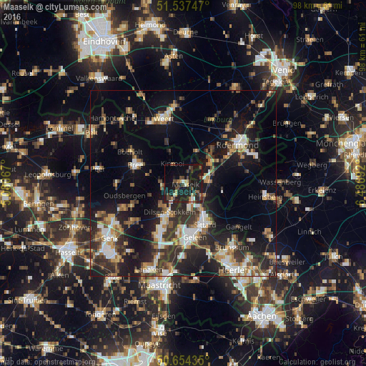
Analysis of Maaseik night lights 2016
Square area 10x10 km:
 1.47%
1.47%90-99
2.01%80-89
2.41%70-79
2.27%60-69
1.87%50-59
3.07%40-49
7.89%30-39
3.88%20-29
7.22%10-19
41.04%0-9
26.87%Square area 50x50 km:
2.71%90-99
4.02%80-89
2.19%70-79
2.89%60-69
3.07%50-59
3.4%40-49
3.97%30-39
4.37%20-29
8.51%10-19
17.7%0-9
47.18%Clear (daylight) street map image can be seen on geolist.org.
Map coordinates:
51° 32' 14.9" North, 5° 4' 50.4" East
51° 5' 52.9" North, 5° 47' 1.6" East
50° 39' 15.7" North, 6° 29' 12.9" East
Some cities around Maaseik sort by population:
• Sittard, NL
12.6 km =7.8 mi,  151°
151°
• Geleen, NL
14.1 km =8.8 mi,  167°
167°
• Bree
13.9 km =8.6 mi,  290°
290°
• Kinrooi
6 km =3.7 mi,  331°
331°
• Stein, NL
14.4 km =8.9 mi,  184°
184°
• Waldfeucht, DE
14.7 km =9.1 mi,  103°
103°
• Lindenheuvel, NL
12.8 km =8 mi, 169°
• Maasbracht, NL
8.5 km =5.3 mi,  57°
57°
2791964 (p: 23,684)
Sources (retrieved 2019-11-25):
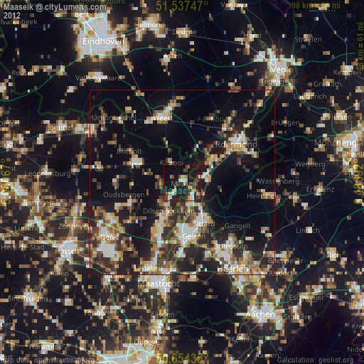
» Earth at Night: Flat Maps 2012, 2016