Kinrooi night lights from space
Night Light of Kinrooi (Flanders) from space (Belgium) Src. Average luminocity for 10x10km area is 8.4693% and for 50x50km: 21.212%.
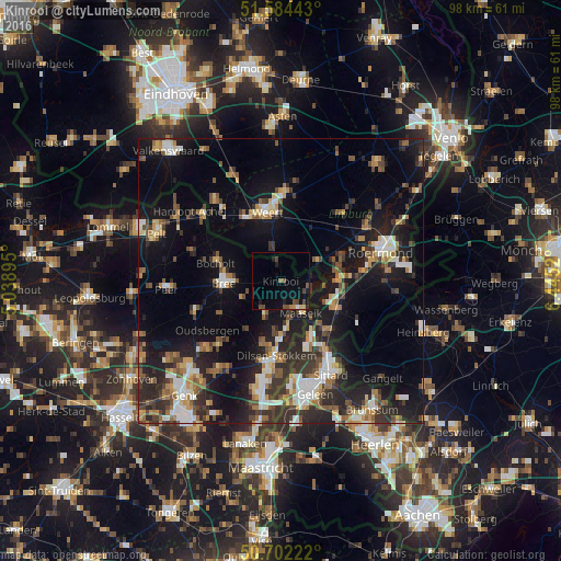
Analysis of Kinrooi night lights 2016
Square area 10x10 km:
 0.4%
0.4%90-99
0.13%80-89
1.07%70-79
0.67%60-69
0.4%50-59
1.6%40-49
4.55%30-39
0.53%20-29
0.94%10-19
5.88%0-9
83.82%Square area 50x50 km:
2.34%90-99
3.19%80-89
2.01%70-79
2.28%60-69
2.87%50-59
2.96%40-49
3.62%30-39
3.68%20-29
7.38%10-19
16.77%0-9
52.89%Clear (daylight) street map image can be seen on geolist.org.
Map coordinates:
51° 35' 3.9" North, 5° 2' 20.2" East
51° 8' 43.5" North, 5° 44' 31.5" East
50° 42' 8" North, 6° 26' 42.7" East
Some cities around Kinrooi sort by population:
• Weert, NL
12.1 km =7.5 mi,  348°
348°
• Maaseik
6 km =3.7 mi,  151°
151°
• Bree
10.1 km =6.3 mi,  267°
267°
• Bocholt
11.7 km =7.3 mi,  285°
285°
• Opglabbeek
15.9 km =9.9 mi,  224°
224°
• Nederweert, NL
15.6 km =9.7 mi,  1°
1°
• Heythuysen, NL
15.9 km =9.9 mi,  43°
43°
• Maasbracht, NL
10.1 km =6.3 mi,  93°
93°
2794445 (p: 11,946)
Sources (retrieved 2019-11-25):
» Earth at Night: Flat Maps 2012, 2016