Frasnes-lez-Buissenal night lights from space
Night Light of Frasnes-lez-Buissenal (Wallonia) from space (Belgium) Src. Average luminocity for 10x10km area is 8.8329% and for 50x50km: 26.1188%.
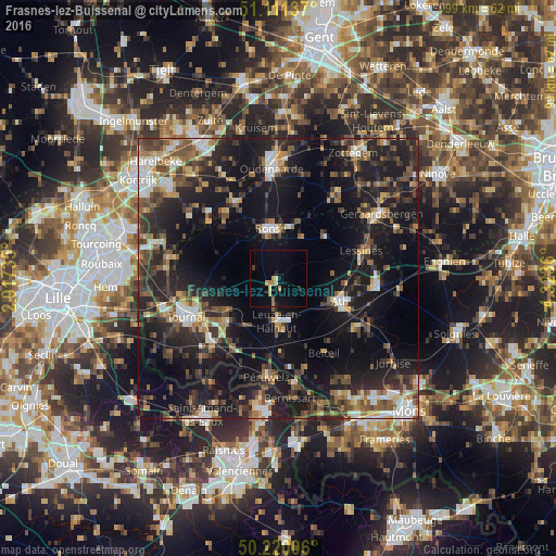
Analysis of Frasnes-lez-Buissenal night lights 2016
Square area 10x10 km:
 0%
0%90-99
0.53%80-89
0.8%70-79
1.87%60-69
2.27%50-59
0.4%40-49
0%30-39
0.53%20-29
1.6%10-19
3.21%0-9
88.77%Square area 50x50 km:
2.58%90-99
3.46%80-89
2.26%70-79
2.66%60-69
3.46%50-59
4.63%40-49
5.19%30-39
5.19%20-29
10.65%10-19
24.38%0-9
35.53%Clear (daylight) street map image can be seen on geolist.org.
Map coordinates:
51° 6' 40.9" North, 2° 55' 2.5" East
50° 40' 4.2" North, 3° 37' 13.7" East
50° 13' 12.2" North, 4° 19' 25" East
Some cities around Frasnes-lez-Buissenal sort by population:
• Ath
11.9 km =7.4 mi,  111°
111°
• Ronse
8.8 km =5.5 mi,  350°
350°
• Lessines
15.9 km =9.9 mi,  72°
72°
• Beloeil
15.3 km =9.5 mi,  148°
148°
• Antoing
16.4 km =10.2 mi,  227°
227°
• Chièvres
15.9 km =9.9 mi,  124°
124°
• Ellezelles
8.6 km =5.3 mi,  29°
29°
• Celles
12.5 km =7.8 mi,  293°
293°
2797979 (p: 10,936)
Sources (retrieved 2019-11-25):
» Earth at Night: Flat Maps 2012, 2016