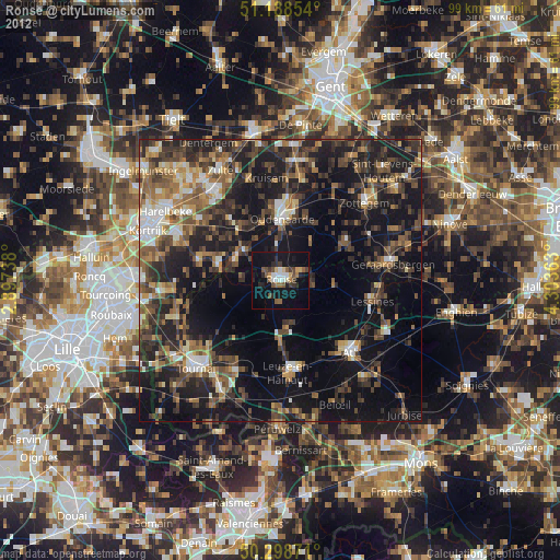
Ronse night lights from space
Night Light of Ronse (Flanders) from space (Belgium) Src. Average luminocity for 10x10km area is 18.4626% and for 50x50km: 28.0801%.
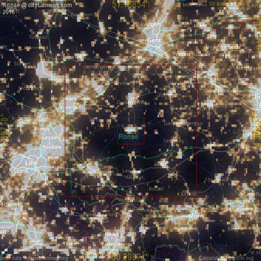
Analysis of Ronse night lights 2016
Square area 10x10 km:
 2.01%
2.01%90-99
3.88%80-89
1.07%70-79
1.34%60-69
1.87%50-59
1.87%40-49
2.41%30-39
1.07%20-29
3.34%10-19
27.14%0-9
54.01%Square area 50x50 km:
2.55%90-99
3.62%80-89
2.43%70-79
3.01%60-69
3.91%50-59
5.48%40-49
5.66%30-39
6.43%20-29
13.04%10-19
21.8%0-9
32.05%Clear (daylight) street map image can be seen on geolist.org.
Map coordinates:
51° 11' 18.7" North, 2° 53' 50.6" East
50° 44' 44.7" North, 3° 36' 1.8" East
50° 17' 55.4" North, 4° 18' 13.1" East
Some cities around Ronse sort by population:
• Oudenaarde
11.8 km =7.3 mi,  2°
2°
• Lessines
17 km =10.6 mi,  103°
103°
• Anzegem
13.3 km =8.3 mi,  319°
319°
• Frasnes-lez-Buissenal
8.8 km =5.5 mi,  170°
170°
• Avelgem
11.4 km =7.1 mi,  287°
287°
• Zingem
18 km =11.2 mi,  11°
11°
• Ellezelles
5.7 km =3.5 mi, 101°
• Celles
10.7 km =6.6 mi,  249°
249°
2787769 (p: 24,204)
Sources (retrieved 2019-11-25):
» Earth at Night: Flat Maps 2012, 2016