Ath night lights from space
Night Light of Ath (Wallonia) from space (Belgium) Src. Average luminocity for 10x10km area is 23.2366% and for 50x50km: 24.6467%.

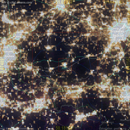
Analysis of Ath night lights 2016
Square area 10x10 km:
 2.41%
2.41%90-99
4.01%80-89
1.47%70-79
3.07%60-69
0.53%50-59
2.67%40-49
5.75%30-39
4.41%20-29
4.28%10-19
39.17%0-9
32.22%Square area 50x50 km:
1.97%90-99
2.92%80-89
2.15%70-79
2.83%60-69
3.58%50-59
4.36%40-49
4.96%30-39
4.65%20-29
9.23%10-19
26.7%0-9
36.65%Clear (daylight) street map image can be seen on geolist.org.
Map coordinates:
51° 4' 23.8" North, 3° 4' 29.6" East
50° 37' 45.7" North, 3° 46' 40.8" East
50° 10' 52.5" North, 4° 28' 52.1" East
Some cities around Ath sort by population:
• Geraardsbergen
17.6 km =10.9 mi,  24°
24°
• Lessines
10 km =6.2 mi, 24°
• Beloeil
9.3 km =5.8 mi,  199°
199°
• Frasnes-lez-Buissenal
11.9 km =7.4 mi,  291°
291°
• Jurbise
14.3 km =8.9 mi,  139°
139°
• Silly
10.5 km =6.5 mi,  78°
78°
• Chièvres
5.1 km =3.2 mi,  156°
156°
• Ellezelles
13.6 km =8.5 mi,  329°
329°
2803010 (p: 26,681)
Sources (retrieved 2019-11-25):
» Earth at Night: Flat Maps 2012, 2016