Fleurus night lights from space
Night Light of Fleurus (Wallonia) from space (Belgium) Src. Average luminocity for 10x10km area is 49.1527% and for 50x50km: 29.9992%.
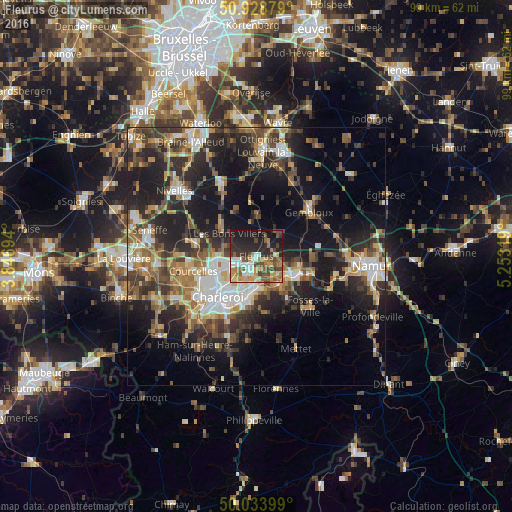
Analysis of Fleurus night lights 2016
Square area 10x10 km:
 5.88%
5.88%90-99
8.12%80-89
5.18%70-79
8.68%60-69
8.54%50-59
9.52%40-49
9.24%30-39
8.4%20-29
17.79%10-19
18.49%0-9
0.14%Square area 50x50 km:
3.94%90-99
4.76%80-89
2.84%70-79
3.94%60-69
4.68%50-59
4.68%40-49
5.36%30-39
6.07%20-29
10.7%10-19
17.34%0-9
35.67%Clear (daylight) street map image can be seen on geolist.org.
Map coordinates:
50° 55' 43.6" North, 3° 50' 49" East
50° 29' 0.6" North, 4° 33' 0.2" East
50° 2' 2.4" North, 5° 15' 11.5" East
Some cities around Fleurus sort by population:
• Charleroi
11 km =6.8 mi,  222°
222°
• Châtelet
9 km =5.6 mi,  189°
189°
• Farciennes
6 km =3.7 mi, 185°
• Aiseau
8.4 km =5.2 mi,  162°
162°
• Villers-la-Ville
9.5 km =5.9 mi,  345°
345°
• La Bruyère
10.9 km =6.8 mi, 155°
• Brunehault
8.7 km =5.4 mi,  286°
286°
• Sombreffe
6.2 km =3.9 mi,  35°
35°
2798297 (p: 22,080)
Sources (retrieved 2019-11-25):
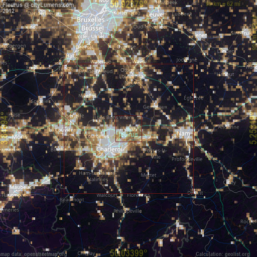
» Earth at Night: Flat Maps 2012, 2016