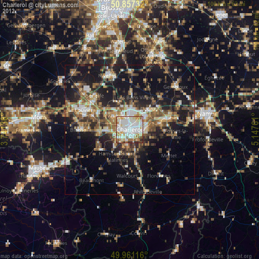
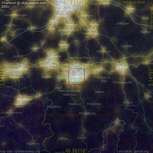
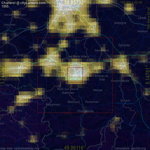
Charleroi night lights from space
Night Light of Charleroi (Wallonia) from space (Belgium) Src. Average luminocity for 10x10km area is 88.1821% and for 50x50km: 26.3361%.
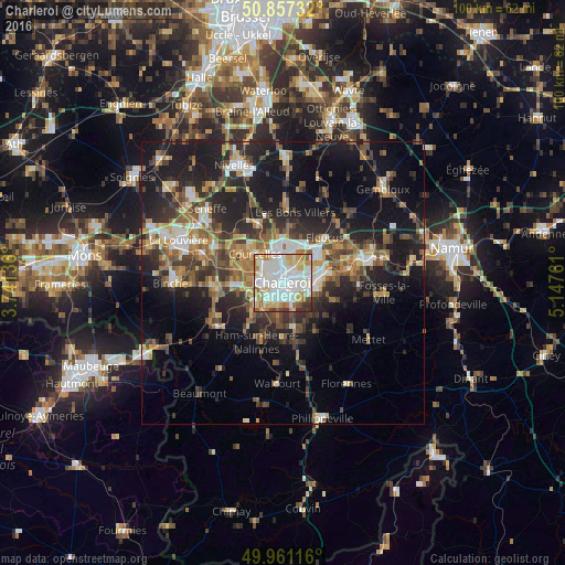
Analysis of Charleroi night lights 2016
Square area 10x10 km:
 34.31%
90-99
29.27%80-89
13.17%70-79
9.38%60-69
5.32%50-59
3.22%40-49
2.52%30-39
2.66%20-29
0.14%10-19
0%0-9
0%Square area 50x50 km:
3.38%90-99
4.29%80-89
2.56%70-79
3.38%60-69
4.07%50-59
4.13%40-49
4.55%30-39
4.99%20-29
8.39%10-19
17.44%0-9
42.83%Clear (daylight) street map image can be seen on geolist.org.
Map coordinates:
50° 51' 26.4" North, 3° 44' 28.9" East
50° 24' 40.9" North, 4° 26' 40.1" East
49° 57' 40.2" North, 5° 8' 51.4" East
Some cities around Charleroi sort by population:
• Châtelet
6 km =3.7 mi,  98°
98°
• Courcelles
7.6 km =4.7 mi,  319°
319°
• Fleurus
11 km =6.8 mi,  42°
42°
• Pont-à-Celles
11.7 km =7.3 mi,  332°
332°
• Gerpinnes
10.1 km =6.3 mi,  144°
144°
• Farciennes
7.2 km =4.5 mi,  73°
73°
• Aiseau
10.1 km =6.3 mi,  89°
89°
• Brunehault
10.5 km =6.5 mi,  355°
355°
2800481 (p: 200,132)
Sources (retrieved 2019-11-25):
» NASA, Earths city lights 1995
» NASA city lights 2003
» Earth at Night: Flat Maps 2012, 2016