La Bruyère night lights from space
Night Light of La Bruyère (Wallonia) from space (Belgium) Src. Average luminocity for 10x10km area is 27.6303% and for 50x50km: 23.1397%.
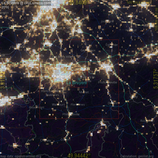
Analysis of La Bruyère night lights 2016
Square area 10x10 km:
 1.54%
1.54%90-99
1.82%80-89
0.56%70-79
3.92%60-69
5.04%50-59
5.88%40-49
6.58%30-39
7.56%20-29
17.23%10-19
24.51%0-9
25.35%Square area 50x50 km:
3.03%90-99
3.82%80-89
2.26%70-79
2.88%60-69
3.51%50-59
3.38%40-49
4.11%30-39
3.99%20-29
7.65%10-19
14.33%0-9
51.04%Clear (daylight) street map image can be seen on geolist.org.
Map coordinates:
50° 50' 27.2" North, 3° 54' 40.8" East
50° 23' 41.2" North, 4° 36' 52" East
49° 56' 39.9" North, 5° 19' 3.3" East
Some cities around La Bruyère sort by population:
• Châtelet
6.2 km =3.9 mi,  278°
278°
• Fleurus
10.9 km =6.8 mi,  335°
335°
• Mettet
8.9 km =5.5 mi,  157°
157°
• Gerpinnes
8.8 km =5.5 mi,  224°
224°
• Farciennes
6.5 km =4 mi,  307°
307°
• Aiseau
2.7 km =1.7 mi, 313°
• Fosses-la-Ville
5.8 km =3.6 mi,  89°
89°
• Floreffe
11.2 km =7 mi,  66°
66°
2793733 (p: 8,194)
Sources (retrieved 2019-11-25):
» Earth at Night: Flat Maps 2012, 2016