Beyne-Heusay night lights from space
Night Light of Beyne-Heusay (Wallonia) from space (Belgium) Src. Average luminocity for 10x10km area is 62.7807% and for 50x50km: 23.3594%.
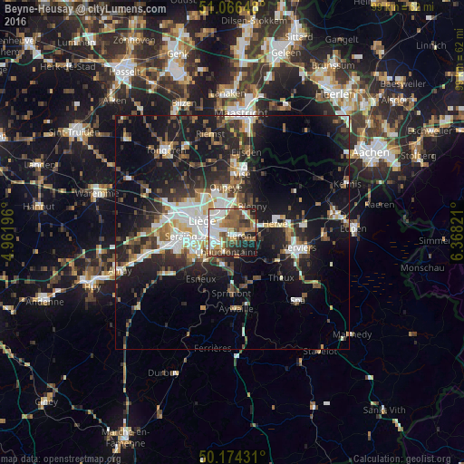
Analysis of Beyne-Heusay night lights 2016
Square area 10x10 km:
100  15.11%
90-99 15.51%
80-89 6.95%
70-79 4.41%
60-69 9.76%
50-59 14.04%
40-49 8.82%
30-39 5.75%
20-29 10.16%
10-19 8.82%
0-9 0.67%
15.11%90-99
15.51%80-89
6.95%70-79
4.41%60-69
9.76%50-59
14.04%40-49
8.82%30-39
5.75%20-29
10.16%10-19
8.82%0-9
0.67%Square area 50x50 km:
100 3.87%
90-99 4.62%
80-89 1.8%
70-79 1.86%
60-69 2.78%
50-59 3.41%
40-49 3.36%
30-39 3.85%
20-29 7.54%
10-19 18.79%
0-9 48.13%
3.87%90-99
4.62%80-89
1.8%70-79
1.86%60-69
2.78%50-59
3.41%40-49
3.36%30-39
3.85%20-29
7.54%10-19
18.79%0-9
48.13%Clear (daylight) street map image can be seen on geolist.org.
Map coordinates:
51° 3' 59.3" North, 4° 57' 43.1" East
50° 37' 21" North, 5° 39' 54.3" East
50° 10' 27.5" North, 6° 22' 5.6" East
Some cities around Beyne-Heusay sort by population:
• Liège
7 km =4.3 mi,  280°
280°
• Herstal
5.5 km =3.4 mi,  327°
327°
• Chaudfontaine
4.9 km =3 mi,  206°
206°
• Herve
9.3 km =5.8 mi,  77°
77°
• Fléron
1.4 km =0.9 mi,  126°
126°
• Soumagne
5.8 km =3.6 mi,  99°
99°
• Blégny
7 km =4.3 mi,  37°
37°
• Trooz
6.2 km =3.9 mi,  159°
159°
2802015 (p: 11,608)
Sources (retrieved 2019-11-25):
» Earth at Night: Flat Maps 2012, 2016