Nawābganj night lights from space
Night Light of Nawābganj (Rajshahi Division) from space (Bangladesh) Src. Average luminocity for 10x10km area is 31.8452% and for 50x50km: 7.8734%.
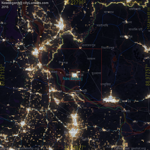
Analysis of Nawābganj night lights 2016
Square area 10x10 km:
 5.36%
5.36%90-99
8.93%80-89
1.59%70-79
3.37%60-69
3.77%50-59
3.17%40-49
1.59%30-39
3.17%20-29
7.74%10-19
36.31%0-9
25%Square area 50x50 km:
0.63%90-99
1.02%80-89
0.57%70-79
0.7%60-69
0.67%50-59
1.47%40-49
1.58%30-39
2.06%20-29
2.72%10-19
7.34%0-9
81.24%Clear (daylight) street map image can be seen on geolist.org.
Map coordinates:
25° 13' 40.7" North, 87° 34' 16.8" East
24° 35' 24.9" North, 88° 16' 28" East
23° 56' 57.4" North, 88° 58' 39.3" East
Some cities around Nawābganj sort by population:
• Rājshāhi
40.9 km =25.4 mi,  126°
126°
• Jangipur, IN
24.1 km =15 mi,  236°
236°
• Dhuliān, IN
34 km =21.1 mi,  287°
287°
• Pakur, IN
44 km =27.3 mi,  277°
277°
• Murshidābād, IN
45.2 km =28.1 mi,  180°
180°
• Shibganj
15.9 km =9.9 mi,  311°
311°
• Lālgola, IN
18.8 km =11.7 mi,  186°
186°
• Farakka, IN
45.4 km =28.2 mi,  303°
303°
1337240 (p: 142,361)
Sources (retrieved 2019-11-25):
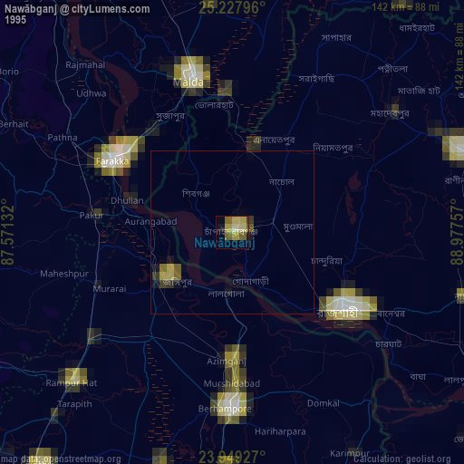
» NASA, Earths city lights 1995
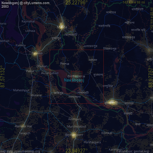
» NASA city lights 2003
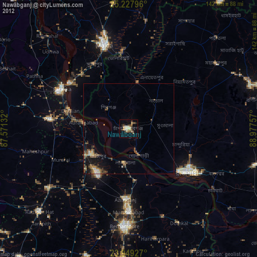
» Earth at Night: Flat Maps 2012, 2016